Huangshan build the mountain by cloud line and contour
Huangshan is not a viewpoint delivered by high-speed rail. The trip begins with a named gateway, timed reservation, shuttle and chosen ascent; it continues through cableway status, stone steps, fast-changing weather and a final descent that must meet the last transport. Build the route as a vertical weather section. Peaks may disappear, seasonal trails may close and sunrise may fail, yet the protected mountain remains meaningful when safety and conservation lead.
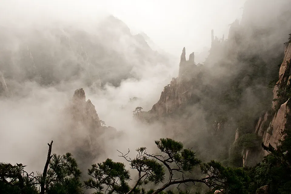
Draw the full vertical journey before choosing a summit
The eight contour bands below separate Huangshan North railway station, Tunxi, Tangkou, the park shuttle, cableways and walking trails. Only after those layers are connected should a traveler choose a day ascent, summit night or lowland heritage branch.
Huangshan North is not the mountain gate
The high-speed station serves the wider city, while the scenic-area approaches and Tunxi old district lie elsewhere. Record the full Chinese destination, official bus or transfer point and last departure before arrival. A fast train from Hangzhou or Shanghai does not remove the road-and-shuttle layer.
Tunxi and Tangkou solve different nights
Tunxi supports rail access, food, the old street and wider Anhui connections; Tangkou is the practical south-gate staging area. Choose by the next morning’s entrance and the final departure, and verify whether lodging transport reaches the official interchange rather than advertising only a mountain view.
Reserve the correct date, gate and direction
Official notices can require real-name, timed and direction-specific booking. Match the identity document, entry gate and ascent plan, then recheck before travel. A ticket is not permission to arrive at a different gate or after the last uphill admission window.
Cableways are operating systems, not guaranteed shortcuts
Yungu, Yuping and Taiping cableways serve different approaches and can change hours, pause for maintenance or close in severe weather. Confirm the live notice, understand which trail the upper station connects to and retain a safe alternative; never pressure staff when wind or inspection suspends service.
Stone steps turn map distance into vertical time
Short horizontal distances can contain long stair sequences, exposed edges and two-way bottlenecks. Choose a one-direction route that matches fitness, daylight and the operating cableway, allow passing space and stay on managed paths. Porters and staff are not a substitute for realistic mobility planning.
An overnight is a logistics choice, not a sunrise promise
Summit lodging can reduce a same-day descent and make early light possible, but rooms, food, water, temperature and luggage options differ from the lowlands. Book through a verifiable channel, carry only what can be managed on stairs and accept cloud, rain or wind without approaching closed viewpoints.
Xihai and high peaks may be closed or capacity-controlled
West Sea Grand Canyon, Tiandu Peak and other exposed routes can use seasonal closure, temporary weather control or separate reservations. Treat every live notice as a route boundary, not a suggestion, and substitute a lower or shorter circuit rather than crossing barriers or relying on an old map.
Hongcun and Xidi are a separate heritage branch
The Anhui villages are not at the summit or automatically included in a Huangshan transfer. Their settlement history, resident life, tickets and road access deserve a distinct day or onward route. Choose a village chapter only after the mountain descent and onward luggage plan remain resilient.
Make three decisions while the map is still quiet
Choose day hike, summit night or lowland base
A day route demands an early confirmed ascent and firm descent cutoff; a summit night adds cost and weather exposure; a lowland-focused visit may suit limited mobility. Decide the format before buying disconnected rail and hotel products.
Commit to one gate-and-cableway logic
Plan the sequence from shuttle to upper station to trail and descent. Reversing direction mid-trip can strand a traveler far from the intended bus or hotel, especially when operating hours or weather shorten the day.
Define the cancellation threshold in advance
Check the official scenic-area notice and current forecast, then decide what wind, lightning, ice, heavy rain or poor visibility will trigger a lower route or rest day. A sunk reservation never makes an exposed trail safe.
A Huangshan plan that closes the loop before dark
The example keeps gateway, mountain and lowland heritage on different levels so a delayed descent does not break an irreplaceable train.
Arrive, identify the interchange and recheck notices
Settle in Tunxi or Tangkou according to the booked entrance, confirm the official transfer and cableway status and prepare a small weather-ready pack. Do not add a late remote village.
Follow one reserved direction
Enter in the booked window, use the operating shuttle and cableway or planned foot ascent and keep the selected trail within fitness and daylight. Descend early enough to absorb queues.
Use a summit morning or protected alternative
If staying high, treat sunrise as optional and follow every closure. If based below, use the buffer for a shorter approved route, Tunxi context or recovery rather than forcing the same exposed plan.
Add one Anhui village only after the mountain
Travel with confirmed road transport and luggage, choose one settlement for a focused visit and avoid an inflexible evening rail departure immediately after the farthest branch.
Mountain weather can invalidate a perfect diagram
Use traction, layers and hands-free luggage
Wear grippy footwear, carry rain and warm layers and keep both hands available on steep sections. Avoid loose umbrellas on exposed ridges and do not take rolling luggage onto a summit route without a confirmed handling plan.
Vertical effort needs conservative pacing
Carry appropriate water and food while respecting site rules, take breaks away from narrow stairs and turn around before fatigue controls the descent. Travelers with health concerns should seek qualified advice and choose a lower format.
Know the final cableway, shuttle and bus
Write down each last operating movement and allow for queues, weather holds and the road back to the base. Never attach the final descent directly to an irreplaceable high-speed train or flight.
Huangshan planning FAQ
How many days does Huangshan need?
Allow at least one arrival night and one full mountain day. Three to five nights provide weather margin, a summit option and one separate lowland village or Tunxi chapter.
Should I stay on the mountain?
Stay high only if the cost, simple logistics, temperature and stair-based luggage movement are acceptable. It improves timing but does not guarantee sunrise, clear views or access during severe weather.
Can I visit Huangshan from Shanghai in one day?
The rail ride is only one layer. Station transfer, road approach, shuttle, entry, ascent and final descent make a same-day return brittle; an overnight near the gateway is the safer useful minimum.
Are all Huangshan trails open year-round?
No. Exposed peaks, canyons, cableways and walking routes may close seasonally, for maintenance, capacity or weather. Read the current official notice immediately before the visit.
Official sources and photo credit
Planning facts and licenses were reviewed on 28 August 2026. Transport, reservations, protected-area access, border rules and local operating arrangements change; verify the current authority or operator close to travel. The image was resized and converted to WebP; its display crop may vary by screen, with no other material changes.
- UNESCO World Heritage Centre — Mount Huangshan.
- Huangshan Municipal People’s Government — official scenic-area travel guide.
- Huangshan Scenic Area Administrative Committee — current operating and closure notices.
- China Railway 12306 — official ticket and identity-document guidance.
- Mount Huangshan in mist — eviltomthai, CC BY 2.0.