Lijiang & Shangri-La follow water before altitude
Lijiang’s canals and uneven lanes form a real settlement system, not just an entertainment district. Northward, elevation rises toward Shangri-La and the journey changes from heritage-city walking to altitude and weather management. Spend enough time in Lijiang to distinguish Dayan, Shuhe and Baisha, then ascend only with a slower first day and current transport information.
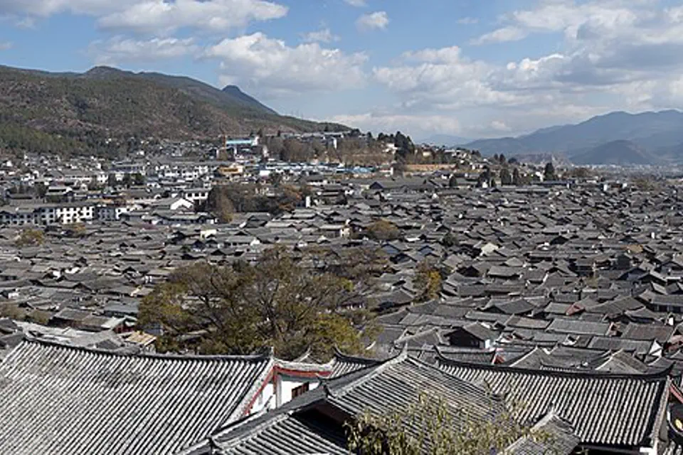
Follow the water channels before climbing the map
The UNESCO town has three components with different pressure and fabric. The higher route introduces weather, Tibetan cultural space and health limits, so these chapters separate urban heritage from plateau ambition.
Old Town as a water-supply system
Walk Dayan early enough to see lanes before peak commerce, trace water rather than only shop streets and use UNESCO context for the relationship between topography, canals and courtyards. Keep residential thresholds and fire-safety rules clear.
A smaller component with its own pressures
Shuhe is not simply “quieter Lijiang.” It has distinct historical fabric and tourism development. Choose a slow walking circuit, avoid horse or animal products with poor welfare and leave commercial lanes for one documented neighborhood edge.
Murals, village life and consent
Baisha’s heritage includes religious paintings and living Naxi community space. Verify opening, follow photography restrictions around murals, ask before portraits and do not interpret residents’ clothing or homes without credible local context.
Water source and mountain frame
Black Dragon Pool helps explain how water reaches the old town and frames Yulong Snow Mountain when visibility allows. Visit for hydrology and urban relationship; never promise the mountain view or treat cloud as a failed day.
Yulong Snow Mountain by altitude, not bravado
Cableway products reach different areas and can close for wind or capacity. Confirm the exact ticket, increase exertion cautiously and do not use bottled oxygen as permission to ignore significant symptoms or official restrictions.
Tiger Leaping Gorge needs trail facts
Road access, trail condition, weather and overnight choices vary. Use current local and operator information, avoid cliff routes in unsafe conditions and keep a simple viewpoint day separate from a multi-day hike in all descriptions.
Rail to Shangri-La changes the body clock
The railway improves access but still raises sleeping elevation. Use the first afternoon for gentle movement, hydration and orientation; avoid scheduling a strenuous monastery, hike or remote drive immediately after arrival.
Religious and community spaces set the rules
Follow local photography and behavior guidance in monasteries and Tibetan neighborhoods, avoid intrusive portraiture and choose interpretation that recognizes living religious practice rather than presenting culture as scenery.
Make three decisions while the map is still quiet
Lijiang station is outside the old lanes
Rail and airport arrivals require a road transfer to a named old-town gate or other base. Wheeled luggage and vehicles do not move freely through every stone lane, so agree on the actual meeting point.
Dayan, Shuhe and Baisha are not interchangeable
Dayan maximizes food and transport with the heaviest crowds; Shuhe offers a different developed settlement; Baisha is smaller and less convenient. Choose by the heritage component you want to inhabit respectfully.
Add Shangri-La only with recovery time
A faster train does not change the elevation gain. Allow gentle time on arrival, keep symptoms visible and avoid a fixed remote excursion before knowing how the traveler responds.
A six-day route that climbs deliberately
Give Lijiang’s component towns three days, use one weather-dependent landscape day and reserve two days for a gentle Shangri-La introduction.
Water lanes and one institution
Trace the canal system in quieter hours, use a museum or documented building for Naxi context and stop before night commerce replaces observation.
Shuhe and Baisha without a race
Choose both only with a simple road chain and generous walking time. Give murals, courtyards and living streets more attention than shopping stops.
Mountain, gorge or lowland alternative
Use current visibility and access to choose Yulong, a safe gorge plan or Black Dragon Pool and town depth. Do not force elevation when conditions are poor.
Shangri-La with a quiet first day
Travel north, keep arrival gentle and visit monastery or landscape only after checking health, weather, cultural rules and the exact return route.
Altitude and heritage both require restraint
Do not dismiss symptoms as lack of fitness
Altitude illness can affect fit travelers. Ascend gradually, keep early exertion mild and seek qualified medical help or descend when serious or worsening symptoms occur; do not self-treat from travel anecdotes.
Old-town access is not luggage-friendly
Uneven paving, steps and vehicle restrictions complicate arrival. Confirm the closest usable gate, ask the accommodation about porter arrangements and keep valuables controlled in crowds.
Murals and worship may forbid cameras
Follow posted rules and staff instructions, ask before photographing people and never use flash, drones or hidden cameras where cultural or conservation restrictions apply.
Lijiang & Shangri-La planning FAQ
How many days do Lijiang and Shangri-La need?
Five to seven nights allow three Lijiang-area days and a slower two- or three-night Shangri-La chapter. A shorter trip should choose one base instead of compressing altitude gain.
Are Dayan, Shuhe and Baisha all part of the UNESCO property?
Yes. The Old Town of Lijiang World Heritage property includes Dayan, Shuhe and Baisha components, each with different form and visitor pressure.
Does taking the train remove altitude risk?
No. Rail changes the transport experience, not the final sleeping elevation. Keep the first high-altitude day gentle and follow evidence-based acclimatization guidance.
Can I do Tiger Leaping Gorge as a quick stop?
A managed viewpoint and a substantial hiking route are different products. Verify road, trail, weather and mobility before describing or booking either one.
Official sources and photo credit
Planning facts and licenses were reviewed on 28 August 2026. Transport, reservations, protected-area access, border rules and local operating arrangements change; verify the current authority or operator close to travel. The image was resized and converted to WebP; its display crop may vary by screen, with no other material changes.