Langkawi works when one island rhythm leads.
Langkawi is not a beach strip with a few attractions attached. The airport coast, Kuah, Machinchang highlands, Kilim mangroves and offshore geosites pull in different directions. Choose the landscape argument first, then make transport boring.
Go beyond the regional overview.
Turn the island into four operating zones: beach base, mountain cable system, mangrove karst and the southern lake. Road and boat contracts matter as much as scenery.
 01
01Pantai Cenang & Pantai Tengah
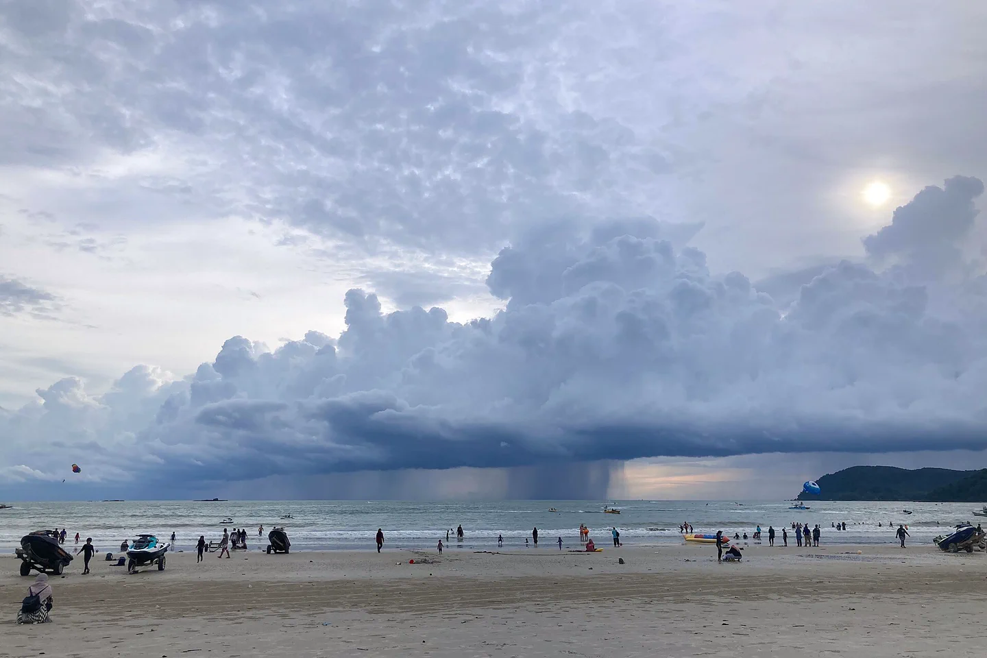
Choose between Pantai Cenang and Pantai Tengah by beach rhythm, road access, water activity and the final evening return.
Open the field guide →02Machinchang & SkyCab
Plan Machinchang and SkyCab around official operating status, cloud, wind, queue strategy and a protected road return.
Open the field guide →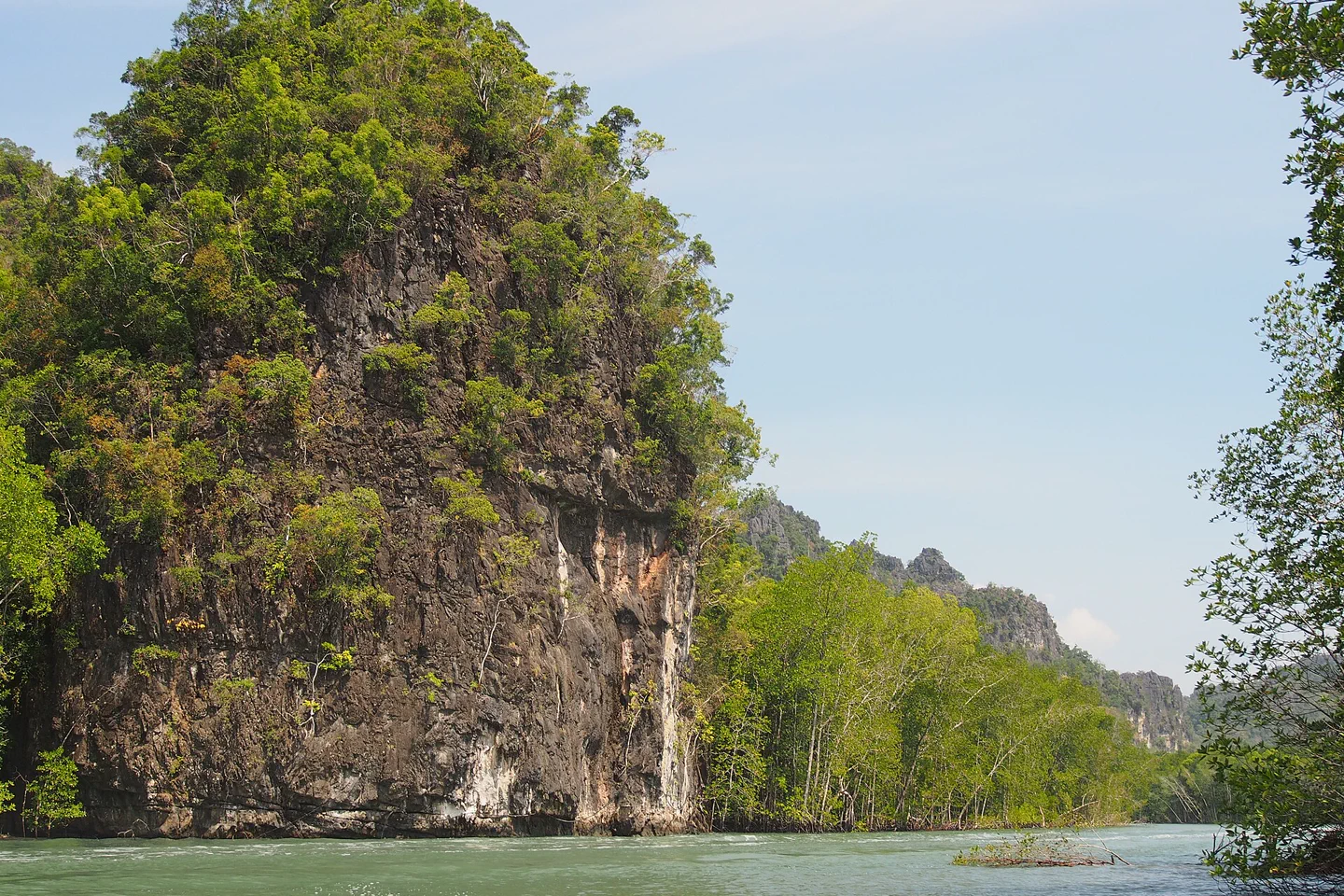 03
03Kilim Karst Geoforest
Choose a responsible Kilim Geoforest boat route with named jetty, wildlife distance, tide awareness and weather fallback.
Open the field guide →04Dayang Bunting Island
Treat Dayang Bunting as a boat, landing and freshwater-lake chain with steps, macaque care and a weather-protected return.
Open the field guide →Choose the edge of Langkawi you want to wake up on.
The right base depends on evening rhythm and the first transfer of the day. A low room price loses its advantage when every meal, jetty or early tour begins with a long ride.
Pantai Cenang & Tengah
The broadest choice for dining, beach access and short airport transfers. It is also developed, active and traffic-prone; check the exact block and whether the room faces nightlife.
Kuah & the southeast
Useful for ferry arrivals, practical errands and local town life. It is not the default swimming-beach experience, so stay here for logistics rather than an assumed resort shoreline.
Machinchang & Kok
Strong for SkyCab, waterfalls and a less urban west coast. Restaurant choice and late transport can be thinner; verify access rather than reading “nearby” from a map.
Tanjung Rhu & Kilim
Choose the north for quieter shoreline and geoforest access. Boat quality, tide, wildlife practice and the return drive matter more than the number of advertised stops.
Three landscapes tell three different island stories.
Langkawi is recognized as a UNESCO Global Geopark. Treat that as a reason to slow down and understand geology, community and conservation—not as a badge that makes every wildlife boat responsible.
Read mangrove, limestone and tide together.
A smaller boat or guided kayak can reveal more than a fast checklist when conditions suit. Ask how the operator manages speed, wake, wildlife distance and food; feeding eagles or macaques changes natural behavior.
Wildlife is not guaranteed. A credible guide explains habitat and keeps distance instead of manufacturing a feeding spectacle.
Machinchang
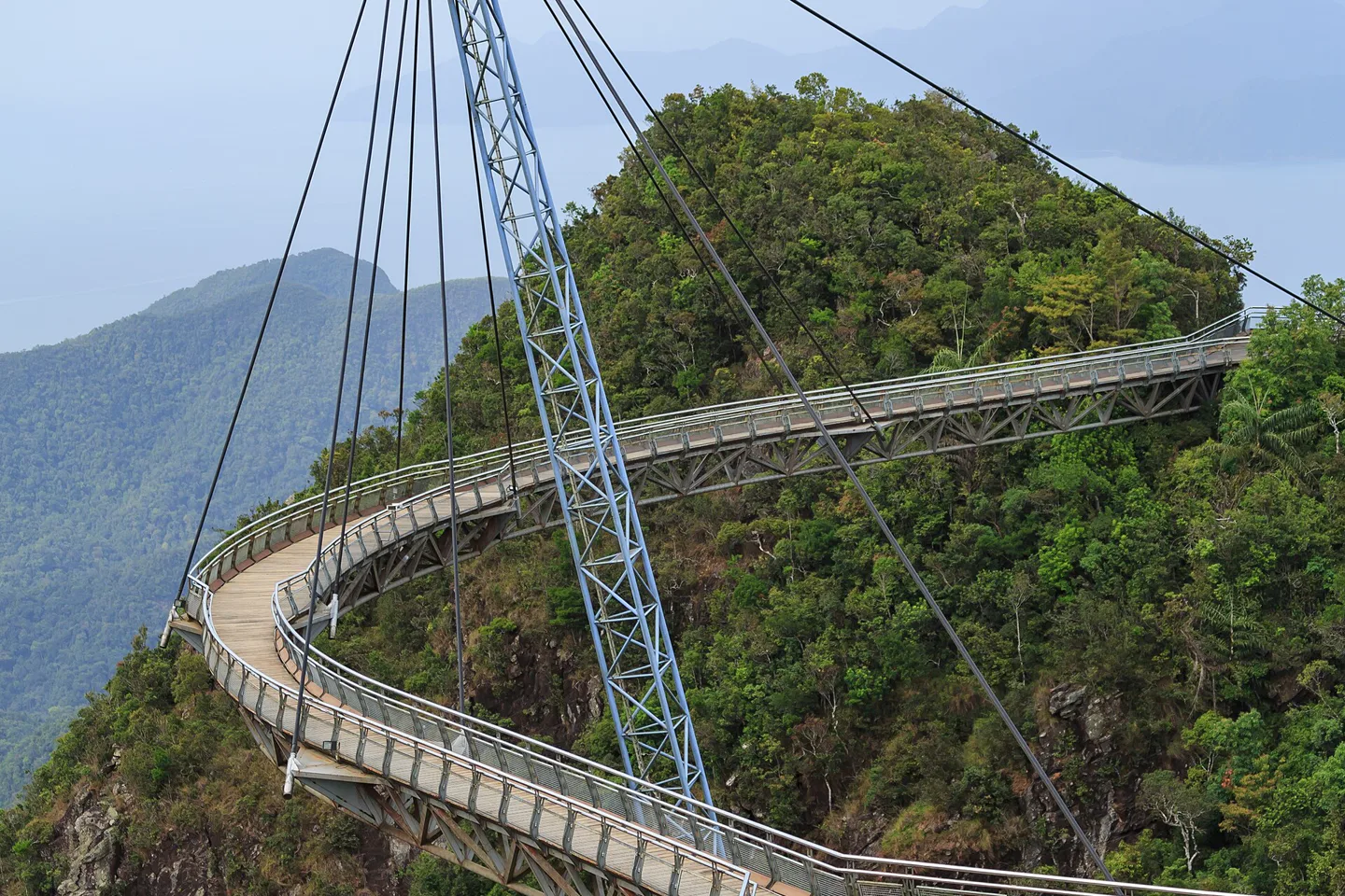
SkyCab and Sky Bridge provide high-elevation access, but wind, lightning, maintenance and visibility can change operations. Check the official operator before committing the whole day.
- Pair with one nearby waterfall or west-coast stop
- Expect temperature and visibility changes aloft
- Keep a ground-level alternative
Kilim
The eastern system is best understood by water. Select an operator by interpretation and environmental practice, then verify tide, duration, boat type and exact jetty.
- Avoid wildlife feeding
- Respect cave capacity and bats
- Bring sun and rain protection
Dayang Bunting
This offshore chapter depends on boat conditions and a walking transfer to the lake. It is not an automatic add-on to every island-hopping package.
- Check landing and walking ability
- Keep food secure around macaques
- Protect the mainland return buffer
Arrival is only the first edge of the circle.
Langkawi has an airport and passenger-ferry connections, but its internal trips are primarily road-based. Boat tours, cable-car operations and mainland ferries remain separate systems.
Name the arrival point
Confirm airport terminal or exact mainland ferry route, then check the current sailing or flight status. Do not assume every ferry gateway operates the same schedule.
Price the whole road day
Compare licensed taxi, e-hailing and a rental car for the actual itinerary. Remote pickup, night return, parking and driver comfort matter more than the headline daily rate.
Book the weather-dependent layer last
Use official notices for SkyCab and direct operator confirmation for boats. Preserve a beach, town or museum alternative instead of forcing a marine or highland trip.
Alternate exposed days with flexible ground days.
This sequence assumes one base. Swap Days 2 and 3 when wind, cloud or rain changes the operating window, and add a fifth night when Langkawi is the trip's recovery chapter.
Land, settle, read the coast
Confirm the departure-day transfer before unpacking. Walk one beach or Kuah district, learn the road scale and save a long cross-island sunset chase for later.
One geoforest system
Choose Kilim by responsible boat or kayak, or Machinchang by official cable-car status. Do not stack both with offshore island hopping.
Beach and lived island
Use the morning for a shoreline that suits current sea conditions, then give Kuah, paddy landscapes or a local food district unhurried time.
Weather reserve or second layer
Add the postponed highland or marine chapter only if conditions cooperate. Otherwise keep the day local and protect the final ferry or flight connection.
The island remains tropical even when the forecast icon looks simple.
Short intense rain, thunderstorms, wind and haze can affect cable cars, beaches, small boats and road visibility differently. Recheck the exact activity on the day.
A beautiful shoreline is not a universal swimming signal.
Observe posted warnings, current water conditions and boat zones. Use reef-safe habits, take litter back, avoid touching marine life and ask before photographing residents or working fishers.
Do not attach an offshore tour to a fixed flight or mainland connection without room for sea, road and check-in delays.
Ask four questions before paying a deposit.
A glossy route description is less useful than clear answers about the operating system.
Which jetty and vessel?
Confirm meeting point, passenger limit, life jackets, duration, cancellation policy and how wildlife encounters are handled.
What closes in bad weather?
Use the official SkyCab status and understand which ticket elements or bridges may pause independently.
Who handles the return?
Confirm late pickup, child seats, fuel and parking terms, or the e-hailing coverage at the furthest stop.
Langkawi planning FAQ
How many nights are useful in Langkawi?
Three nights allow one beach day and one focused landscape day. Four or five provide a weather buffer and time for a second geoforest or slower island chapter.
Do I need a car in Langkawi?
Not every visitor needs to drive, but the island is dispersed and public transport is limited. Compare a rental car with licensed taxi or e-hailing availability for the exact base and late return.
Can I combine every geoforest park in one day?
That creates a transfer-heavy checklist. Machinchang, Kilim and Dayang Bunting use different access systems, so choose one principal landscape and verify its conditions.
Should I stay in Kuah or Pantai Cenang?
Choose Kuah for ferry logistics and town services; choose Cenang or Tengah for a beach-centered stay and broader evening choice. Verify the exact block rather than the district name alone.
Is a mangrove tour automatically eco-friendly?
No. Ask about group size, boat speed, wake, guide interpretation and wildlife feeding. Conservation language is useful only when operating practice supports it.
Can I tour on the same day as my departure?
Keep the final day conservative. Wind, rain, boat delays and road travel can turn a fixed ferry or flight into a fragile connection.
Official sources and photo credits
Planning facts and licenses were reviewed on 29 August 2026. Ferry schedules, cable-car status, tour operations and weather change; verify directly before travel. Photographs were resized, center-cropped to 1440 × 960 and converted to WebP; no other material edits were made.
- Tourism Malaysia — Langkawi destination guide.
- UNESCO — Global Geoparks list and program context.
- Panorama Langkawi — official SkyCab and attraction notices.
- METMalaysia — official marine forecast.
- Langkawi Sky Bridge — CEphoto, Uwe Aranas, CC BY-SA 3.0.
- Kilim Geoforest Park — Dcpeets, CC BY-SA 4.0.
- Pantai Cenang — Nahid Sultan, CC BY-SA 4.0.