Abruzzo National Parks
Base near the selected park, check its authority and gateway before departure, ascend only through the verified road, lift or trail system, and descend while weather, daylight and the final transport remain strong.
Begin where the transport actually ends.
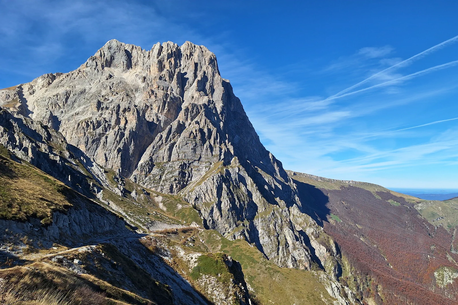
None of the three national parks has one entrance or one universal station. Gran Sasso access changes by the chosen L’Aquila, Teramo or plateau side; Majella uses separate towns and valleys such as Caramanico Terme; Abruzzo–Lazio–Molise has its own gateway towns and roads. Name the base, transport leg, trailhead and descent before departure.
Know what the chosen line leaves out.
Driving between distant gateways or changing parks after a closure consumes the safety margin needed for the mountain itself. One park and one operating layer sacrifices regional coverage but preserves interpretation, daylight and an honest fallback.
Marche & Abruzzo has four layers to align.
The Adriatic rail spine makes Pesaro and Ancona look simple, but Urbino, Monte Conero and Abruzzo’s mountain parks begin only after distinct bus, road, trail and weather thresholds. A useful regional plan separates the coast-to-hill transfer from the destination day and never treats two large national parks as adjacent attractions.
BASE
Two nights supports Pesaro with one Urbino day or Ancona with one Conero branch. Abruzzo’s parks deserve their own inland base and weather reserve; four or more nights are more realistic when combining a Marche coast stay with one mountain gateway.
TRANSFER
Pesaro and Ancona sit on the Adriatic railway, while Urbino requires a bus connection and Conero trail or beach access depends on the selected town and seasonal road or transit pattern. Gran Sasso and Majella have multiple gateways; choose the exact valley, visitor centre, road or lift before booking accommodation.
SEASON
Beach access, headland buses and road pressure change sharply in summer, while rain, heat and fire conditions affect Conero paths. Snow, wind, storms, road closures and lift operations control the mountain parks. A city or lower-valley fallback is part of the itinerary, not an afterthought.
LOWER-RISK DAY
Use Pesaro, Ancona or the chosen Abruzzo gateway town as a complete lower-risk day when an inland bus, trail, beach descent, road or mountain system fails. Do not cross to another park or coast simply because the original headline is unavailable.
Arrive, cross one gate, use one layer, then protect the return.
Check the selected park authority and exact gateway for road, lift, trail, fire, snow, wildlife and weather status; confirm accommodation-side transport, daylight and the final descent before leaving.
- 01Arrive
Confirm one park authority
Open the chosen park’s current notices, weather and access information, then match them to one named gateway and route. Do not depart with only a regional map pin.
- 02Cross the threshold
Enter through the lower threshold
Reach the visitor centre, town, Fonte Cerreto system or selected trailhead and reassess wind, road, lift and group ability before ascending.
- 03Use the layer
Use one altitude layer
Complete the approved low, middle or high route without stacking a second valley. Carry the required water, clothing and navigation, and observe protected-area rules.
- 04Protect the return
Descend before the margin disappears
Turn back at the planned time, recover the road, lift or transport gateway and reach the base before darkness or a final operating cutoff.
Reopen the pages that control today’s gate.
The guide provides the decision structure; these authorities control admission, transport, paths, weather, marine operation and closures.
- Gran Sasso and Monti della Laga National Park — official access and conditions.
- Majella National Park — official routes and visitor information.
- Abruzzo, Lazio and Molise National Park — official visitor information.
- Adriabus — official Pesaro and Urbino area bus information.
- Parco del Conero — official headland and trail information.
Keep a complete alternative, not fragments.
If high roads, lifts or trails close, remain at the selected gateway for the visitor centre, town heritage and a low-level park-approved walk. Do not transfer to the other national park on the assumption that conditions will be better there.
Check the selected park authority and exact gateway for road, lift, trail, fire, snow, wildlife and weather status; confirm accommodation-side transport, daylight and the final descent before leaving.
Change the plan while the return is still strong.
Park scale defeats vague access
A park name can span many valleys and hours of road travel. The exact gateway and route must appear in the day plan and accommodation choice.
Altitude changes faster than the city forecast
Wind, snow, heat and storms can alter roads, lifts and trails independently. Use the park authority and local conditions at the threshold.
Remote returns need redundancy
Mobile coverage, roadside services and public transport can be limited. Carry offline details, leave the route with a responsible contact and turn back before the final option.
Other complete ways to use Marche & Abruzzo.
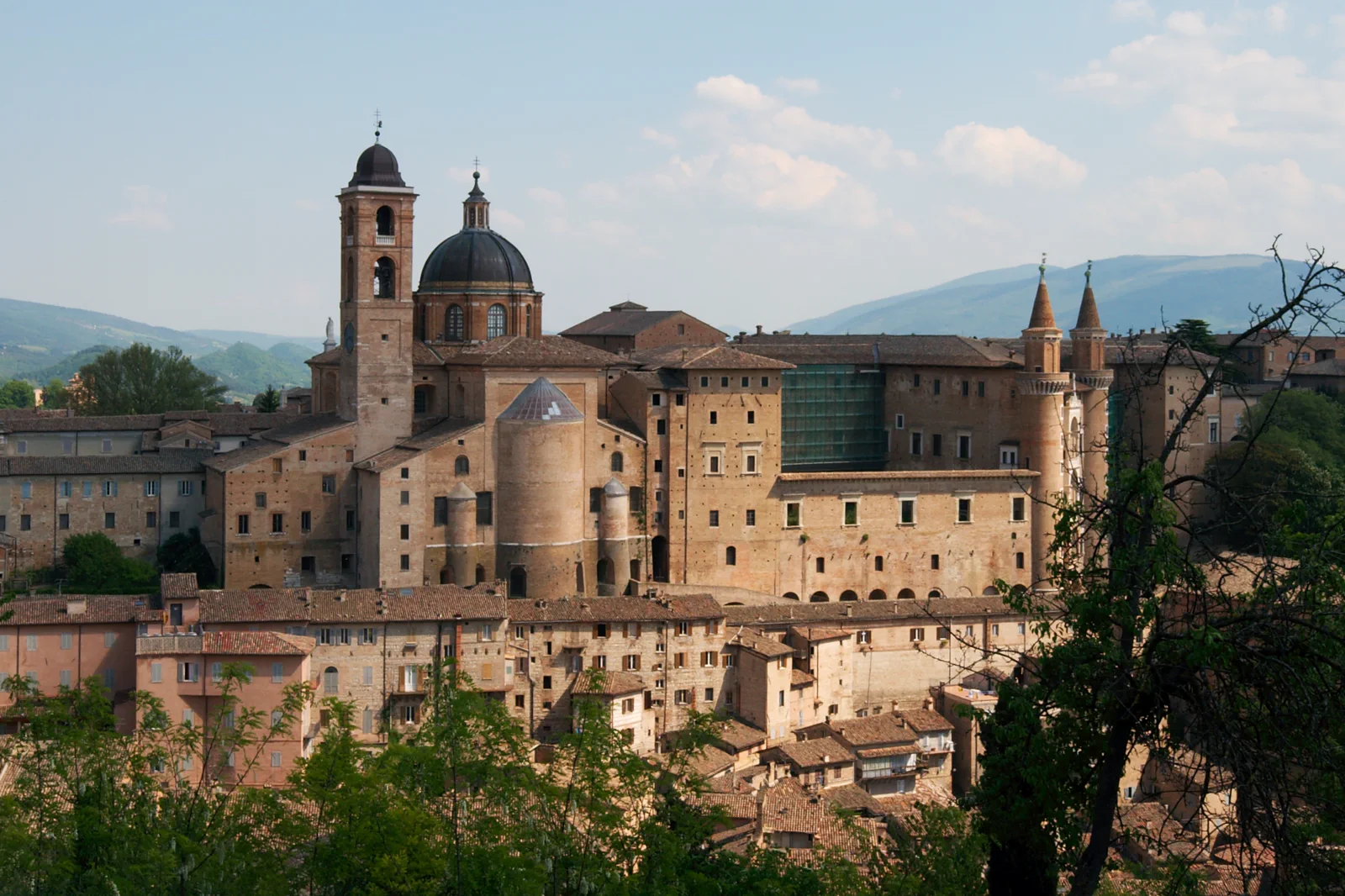
Urbino & Pesaro
Choose Pesaro as a rail-connected city, Urbino as a hill-town and collection day, or a carefully timed split, and make the…
Open this route folio →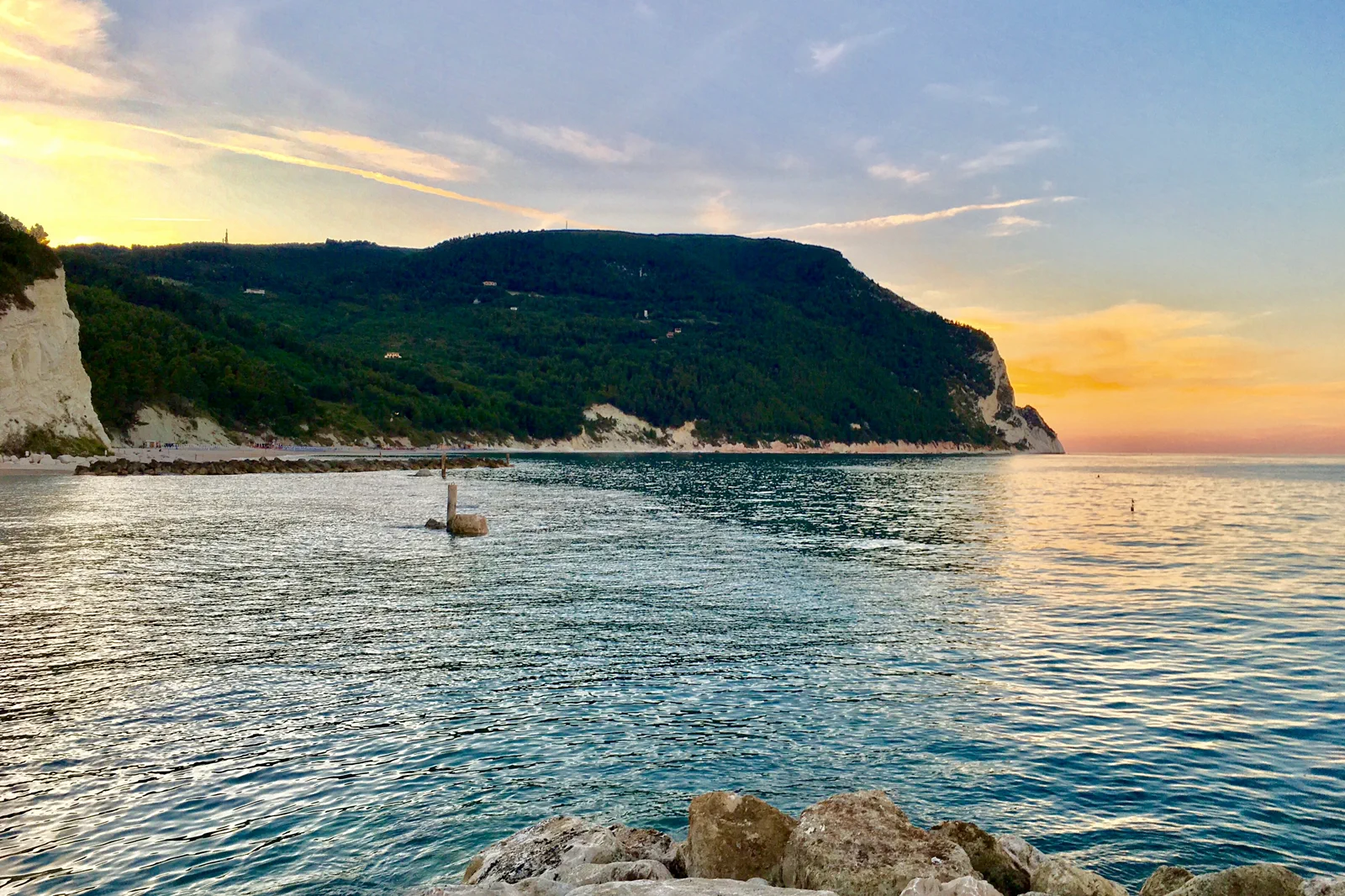
Ancona & Monte Conero
Choose Ancona’s port-and-hill city, a Sirolo or Numana coast base, or one verified Conero trail and beach approach, because…
Open this route folio →Abruzzo National Parks FAQ
How much time should I give Abruzzo National Parks?
Give any one of the three parks a full day from a nearby inland base, plus a weather reserve when a high route matters. None is a credible casual add-on from Rome or the Adriatic coast without a precise transport contract.
What should I combine with Abruzzo National Parks?
Combine one park gateway with one altitude or habitat layer and its lower town. Keep the other parks, Conero and Urbino for separate days and bases.
What should I verify before leaving?
Check the selected park authority and exact gateway for road, lift, trail, fire, snow, wildlife and weather status; confirm accommodation-side transport, daylight and the final descent before leaving.
Official sources and photo credits
Planning facts and image licensing were reviewed on 26 September 2026. Admission, rail, roads, ZTLs, paths, ferries, weather and local access can change; reopen the linked authority or operator before travel.
- Gran Sasso and Monti della Laga National Park — official access and conditions.
- Majella National Park — official routes and visitor information.
- Abruzzo, Lazio and Molise National Park — official visitor information.
- Adriabus — official Pesaro and Urbino area bus information.
- Parco del Conero — official headland and trail information.
- Urbino-palazzo e borgo.jpg — Il conte di Luna, CC BY-SA 2.0. Resized, display-cropped and converted to WebP; no other material edits.
- Monte Conero visto dalla spiaggia Urbani.jpg — Gabri307, CC BY-SA 4.0. Resized, display-cropped and converted to WebP; no other material edits.
- Gran Sasso seen from East.jpg — PaulFo, CC0. Resized, display-cropped and converted to WebP; no other material edits.