Mui Ne & Binh Thuan A coast measured in wind, sand, Cham memory and sea-state decisions.
Mui Ne and the wider Binh Thuan coast are not only a resort strip. Red and white dunes, working fishing villages, Cham towers, forested hills, a lighthouse coast and the remote island of Phu Quy each run on a different clock. Use this hub to choose the landscape that matches your weather window, mobility and appetite for exposure.
- Useful stay
- Use Ham Tien or Mui Ne as the first mainland base, then add Phan Thiet, the Ta Cu coast or an island night only when…
- Transfer logic
- Solve the mainland arrival through Phan Thiet and Muong Man first; keep a weather buffer for dune roads, boat…
Open the place at the right scale.
Each card solves a different transport, access or conduct problem. None is a placeholder.
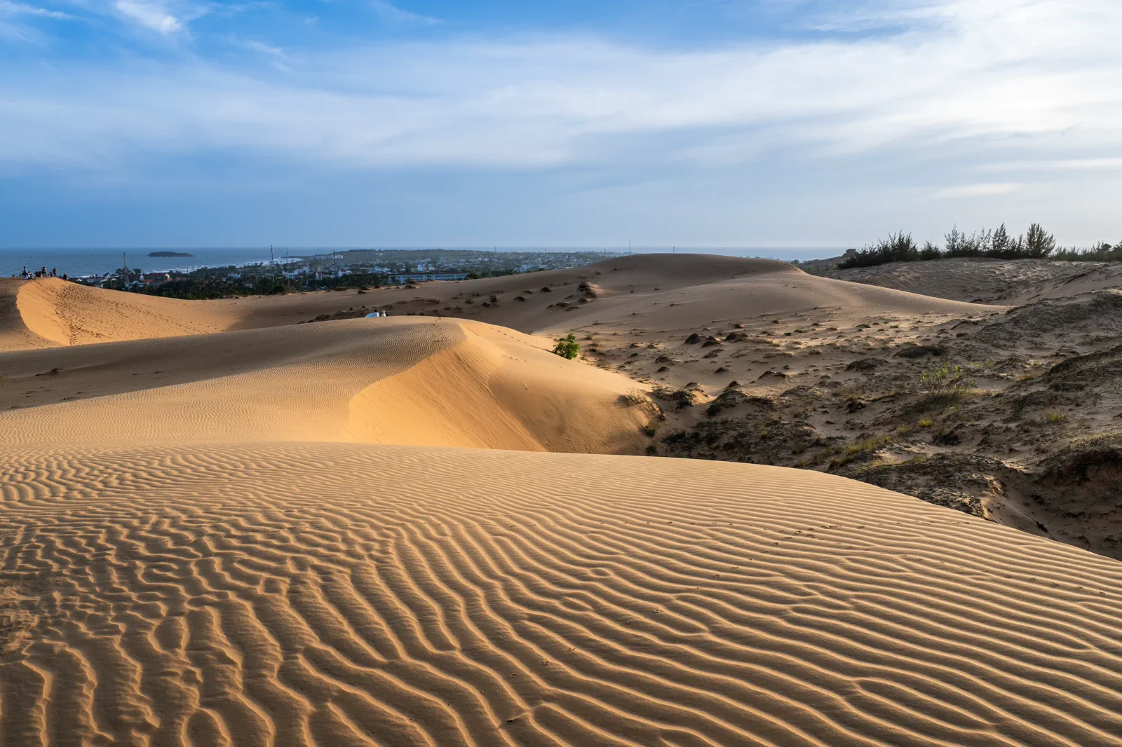
01Mui Ne Red Sand Dunes at Golden Hour
A practical sunrise and sunset chapter for reading Mui Ne’s red dunes without turning a fragile landscape into an off-road playground.
Open the field guide →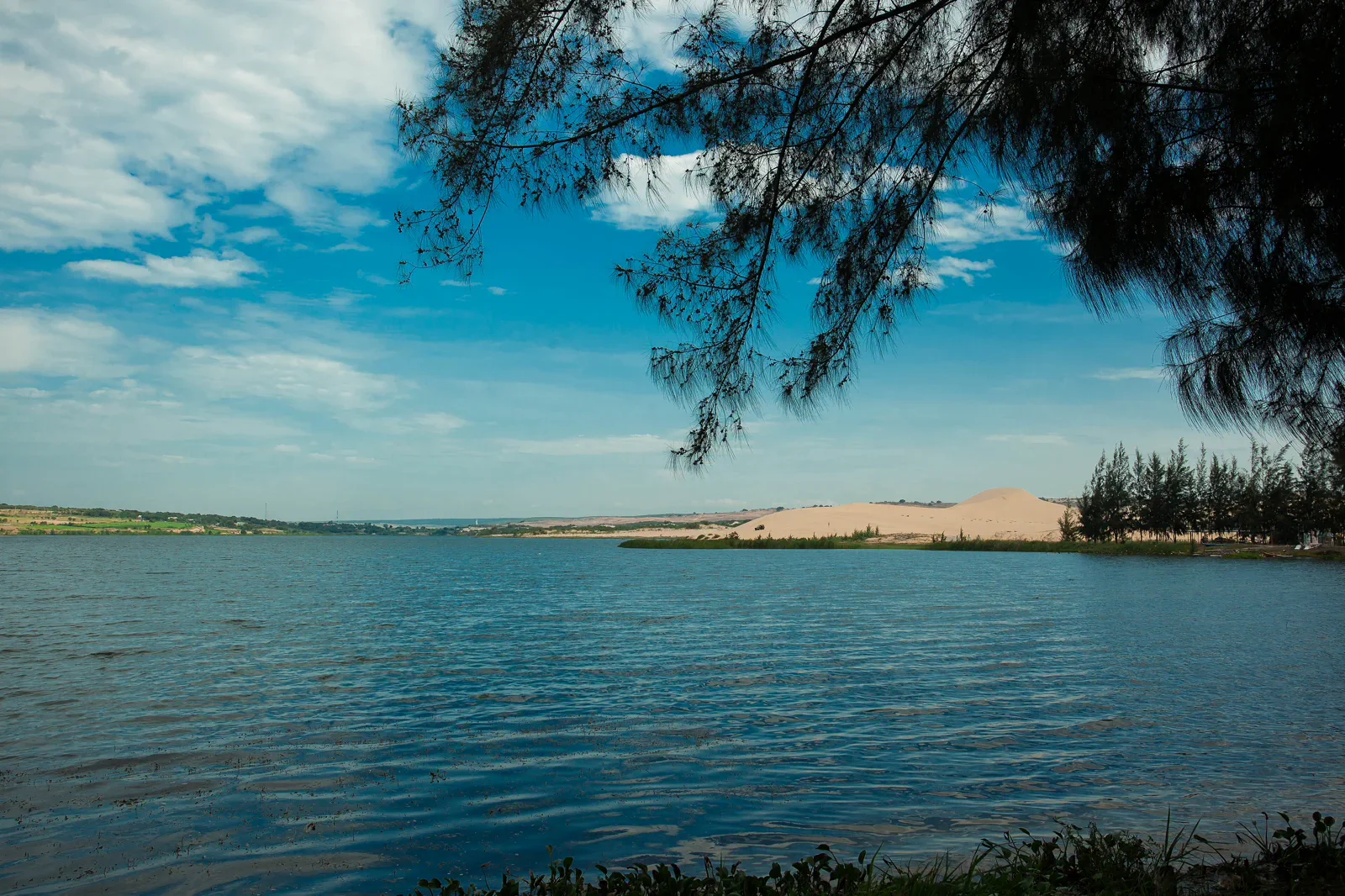 02
02Bau Trang White Dunes & Lotus Lake
Plan the longer coastal run to Bau Trang around the sharp meeting of white dunes, freshwater lakes and a road exposed to sun and wind.
Open the field guide →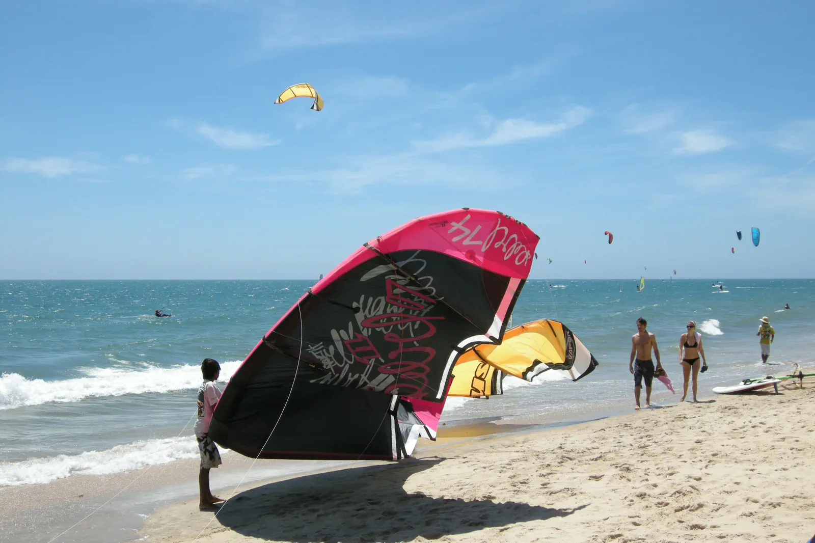 03
03Mui Ne Kiteboarding Coast
A wind-and-water planning guide for choosing a safe lesson, understanding beach launch zones and leaving enough space for changing sea conditions.
Open the field guide →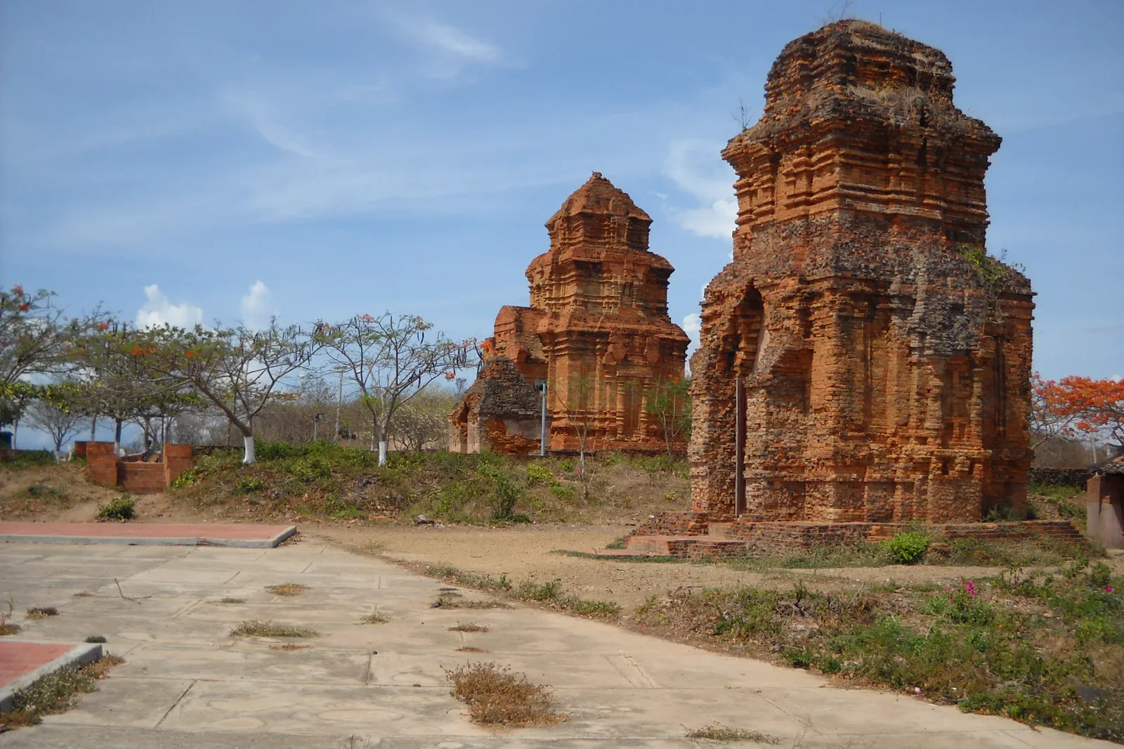 04
04Phan Thiet Fishing Coast & Po Sah Inu Heritage
Connect Phan Thiet’s working fishing coast with Po Sah Inu’s Cham architecture through a respectful heritage route with two distinct visitor contracts.
Open the field guide →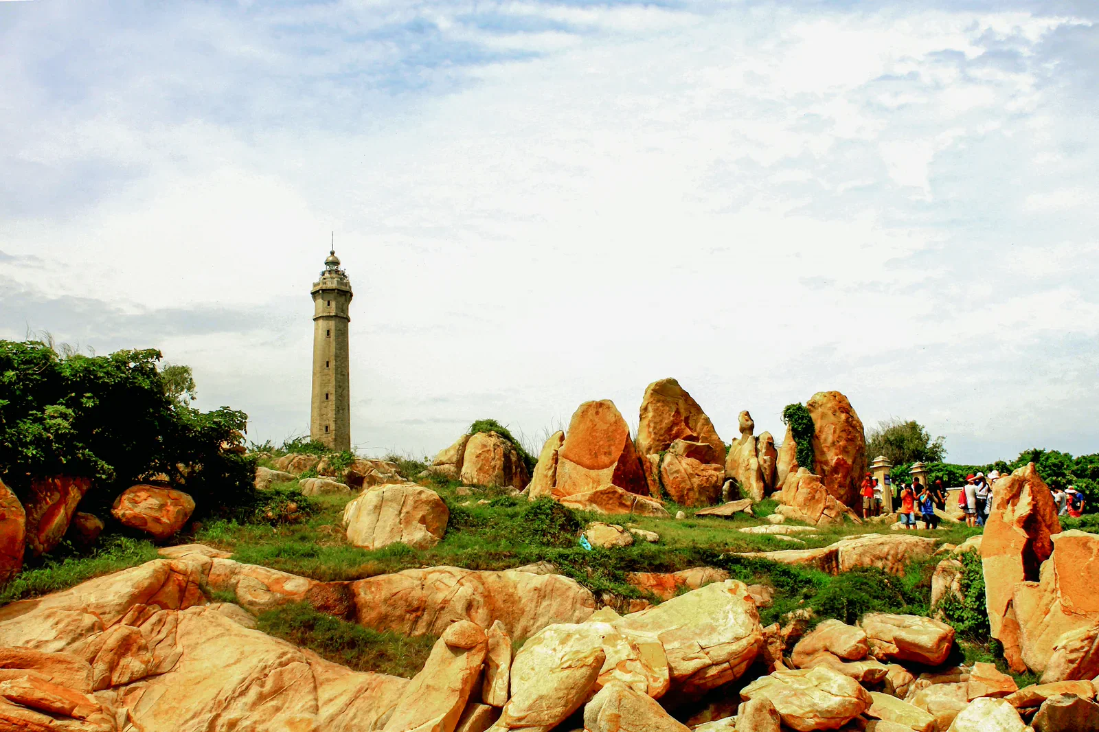 05
05Ta Cu Mountain & Ke Ga Coast
A mainland-to-coast chapter that separates Ta Cu’s forested religious ascent from the tide-dependent Kê Gà lighthouse landing.
Open the field guide →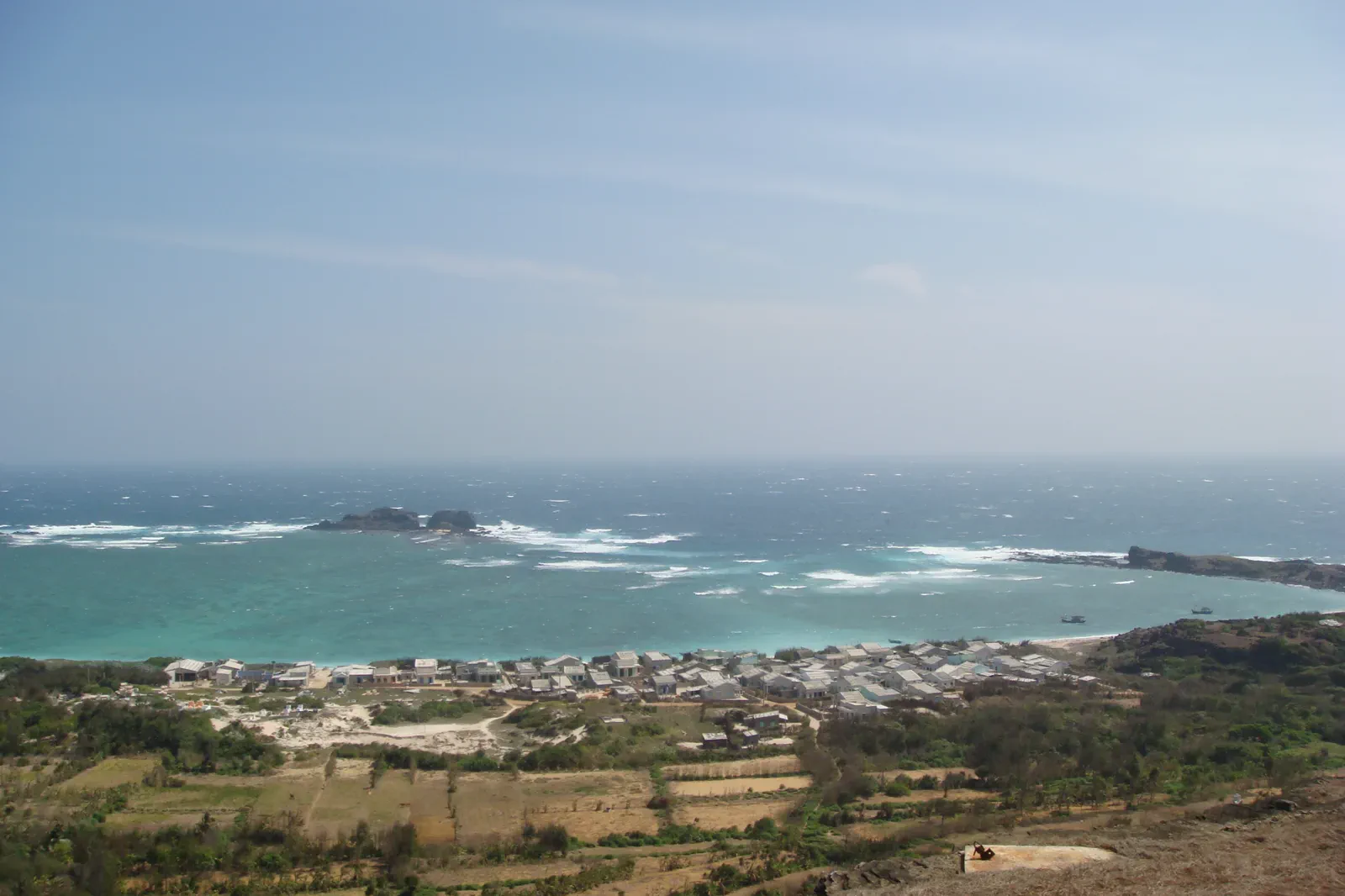 06
06Phu Quy Island: A Remote Island Rhythm
Treat Phu Quy as a remote island stay with its own sea crossing, local shrines, fishing life and limited-service buffer rather than a quick mainland excursion.
Open the field guide →Six chapters, six different conditions.
Distance, weather, sacred space, working neighborhoods and protected landscapes cannot share one generic checklist.
Mui Ne Red Sand Dunes at Golden Hour
Arrive with water, covered shoulders, secure footwear and a confirmed meeting point. If using a board, quad bike or 4x4, choose the designated operator area before entering the dunes.
Keep the boundaryDo not combine the red dunes with every nearby stop by default; heat, wind and the ride back are part of the route rather than empty space.Bau Trang White Dunes & Lotus Lake
Start with a reliable vehicle, offline directions and enough water for a remote-feeling stop. Confirm the currently recognized access point because roads, parking and visitor arrangements can change.
Keep the boundaryThe lake edge, lotus beds and dune vegetation are not interchangeable photo surfaces; keep the landscape readable for the next visitor.Mui Ne Kiteboarding Coast
Book with a school that explains equipment, rescue cover, launch space and beginner limits. Arrive ready for sun, wind-blown sand and a possible weather pause.
Keep the boundaryDo not treat a clear horizon as proof of safe water; wind direction, current, crowding and instructor judgment outrank a prewritten itinerary.Phan Thiet Fishing Coast & Po Sah Inu Heritage
Use a named pier, market or tower entrance and confirm local access before setting out. Carry modest clothing for the towers and avoid entering working areas without invitation.
Keep the boundaryDo not photograph people, prayer or restricted structures as if they were staged exhibits; the route is strongest when visitors leave room for local life.Ta Cu Mountain & Ke Ga Coast
Confirm the current Ta Cu entrance and cable-car or trail options, then ask the Kê Gà operator about tide, landing and lighthouse access before committing.
Keep the boundaryNever turn a closed trail, lighthouse or rocky landing into a challenge; a changed viewpoint is better than an avoidable rescue.Phu Quy Island: A Remote Island Rhythm
Book through a current authorized operator, carry identification and protect against seasickness. Keep one uncommitted day in the wider itinerary in case the crossing moves.
Keep the boundaryThe island is a working community and a strategic maritime place; do not trespass, photograph restricted facilities or treat residents as scenery.Protect the transfer before adding the view.
This is an editorial sequence, not a promise that every activity operates every day.
Mui Ne Red Sand Dunes at Golden Hour
Cool-hour arrival, low-impact contour reading, one activity choice and a shaded return make a reliable half-day chapter.
Chapter 02Bau Trang White Dunes & Lotus Lake
Mainland departure, lake orientation, dune contour and a weather-aware return form the route.
Chapter 03Mui Ne Kiteboarding Coast
Shore briefing, land practice, water decision and a conservative exit create the chapter’s logic.
Chapter 04Phan Thiet Fishing Coast & Po Sah Inu Heritage
Harbor observation, transition through Phan Thiet, tower reading and a quiet meal complete the cultural chapter.
Chapter 05Ta Cu Mountain & Ke Ga Coast
Forest elevation, a deliberate recovery, coastal approach and a tide-aware return keep the geography legible.
Chapter 06Phu Quy Island: A Remote Island Rhythm
Mainland port, sea crossing, island road loop, cultural pause and return buffer define the chapter.
Mui Ne & Binh Thuan FAQ
How much time should Mui Ne Red Sand Dunes at Golden Hour receive?
Allow a focused half day, with the exact light window chosen around the current forecast rather than a fixed promise.
How much time should Bau Trang White Dunes & Lotus Lake receive?
Reserve most of a day including the mainland drive, rather than treating Bau Trang as a quick detour.
How much time should Mui Ne Kiteboarding Coast receive?
Use a half or full day depending on the school’s lesson plan, with no fixed promise that wind will cooperate.
How much time should Phan Thiet Fishing Coast & Po Sah Inu Heritage receive?
Allow a half to full day, with extra time if a local festival or heritage program is active.
How much time should Ta Cu Mountain & Ke Ga Coast receive?
Plan a full mainland day and keep an additional buffer if the lighthouse landing is important.
How much time should Phu Quy Island: A Remote Island Rhythm receive?
Give the island several nights when possible, plus an unused buffer before any flight or fixed mainland commitment.
Official sources and photo credits
Planning facts and image licenses were reviewed on 31 August 2026. Recheck transport, entry, weather, park and operator conditions before travel.
- Vietnam Tourism — Binh Thuan.
- Vietnam Tourism — Mui Ne: Sand Dunes and Water Sports.
- Binh Thuan government — Mui Ne National Tourism Area plan.
- Phu Quy Special Zone government — Tourism.
- Mui Ne sand dunes — Monster4711, CC BY-SA 3.0. Resized, display-cropped and converted to WebP; no other material edits.
- Bau Trang — Hưng Hồ Bá, CC BY 2.0. Resized, display-cropped and converted to WebP; no other material edits.
- Kites on the beach at Mui Ne — Vyacheslav Argenberg, CC BY 4.0. Resized, display-cropped and converted to WebP; no other material edits.
- Po Sah Inu Cham Towers — Dongson*vmvn at Vietnamese Wikipedia, CC BY-SA 3.0. Resized, display-cropped and converted to WebP; no other material edits.
- Ke Ga Lighthouse — Bùi Thụy Đào Nguyên, CC BY-SA 4.0. Resized, display-cropped and converted to WebP; no other material edits.
- Linh Son Pagoda on Phu Quy — Thái Nhi, Public domain. Resized, display-cropped and converted to WebP; no other material edits.