Tasmania Choose a gateway, then let weather and road time set the island route.
Lutruwita / Tasmania rewards a route drawn around nights and gateways, not a fast-looking island loop. nipaluna / Hobart, kunanyi, the Tasman Peninsula, Launceston, Cradle Mountain and Freycinet occupy different operating systems: city walking, exposed alpine access, booked heritage entry, regional road transfer and weather-dependent park tracks. The five field guides ask which of those systems belongs on this trip and where the bed must be before the day begins. A place on a map is not a short hop; winding roads, daylight, wildlife, cold fronts and park closures decide whether two stops fit. Use the first morning and final connection as bookends: an early park start needs a nearby bed, while a late ferry or flight may need a separate Devonport, Hobart or Launceston night. When a road closure removes a leg, protect the arrival and return first, then drop one region; do not make a night drive the device that restores every pin.
- Useful stay
- Planning estimate: three nights in Hobart support the southern city and one nearby decision; add a Tasman Peninsula night…
- Transfer logic
- Fly to Hobart or Launceston, or reserve the Spirit of Tasmania crossing to Devonport with the correct vehicle dimensions and…
Choose the operating system, then the place.
Every card opens a full route with transport, access, weak points, official sources and visible image provenance.
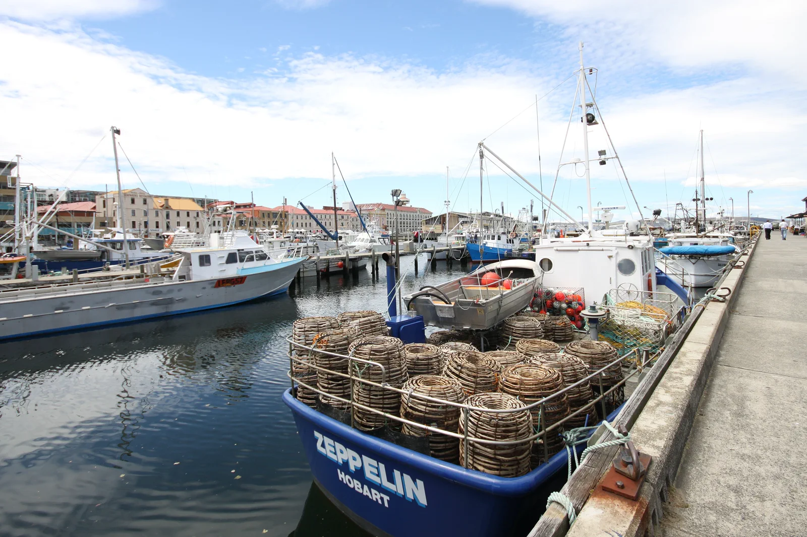
nipaluna / Hobart & Salamanca
Build a Hobart day from one indoor collection, the working waterfront and Salamanca Place. Saturday market is a calendar-specific version of the route, not the definition of Salamanca; Battery Point adds steps and a hill, while the lower harbour loop is the simpler return.
Open the field guide →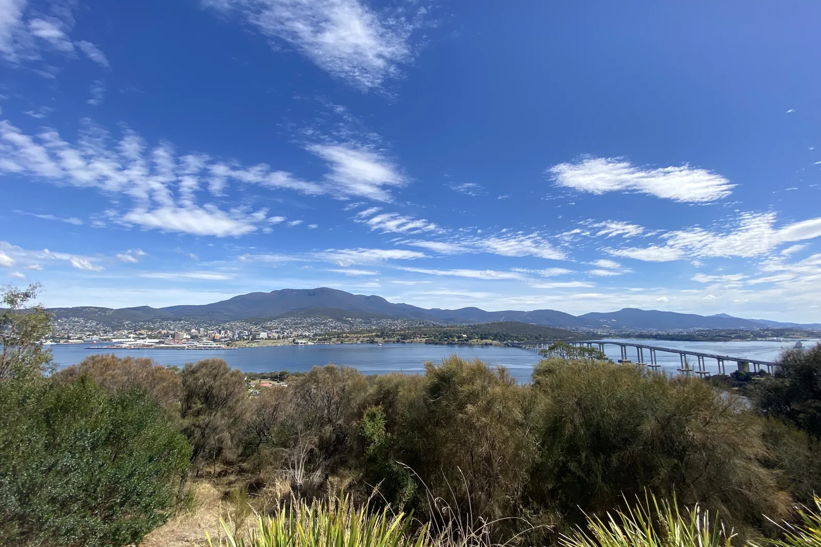
kunanyi / Mount Wellington
A mountain chapter where summit road, bus, snow, wind and palawa naming determine whether the high point or a lower trail is appropriate.
Open the field guide →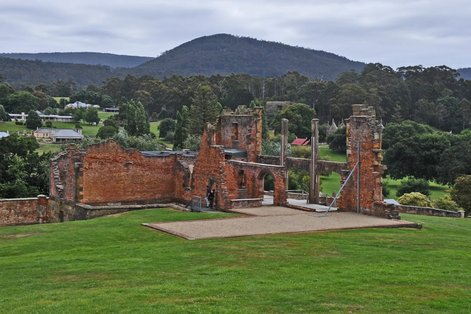
Port Arthur & Tasman Peninsula
A peninsula day giving the Port Arthur collection enough solemn attention before one formal coastal viewpoint and a safe road return.
Open the field guide →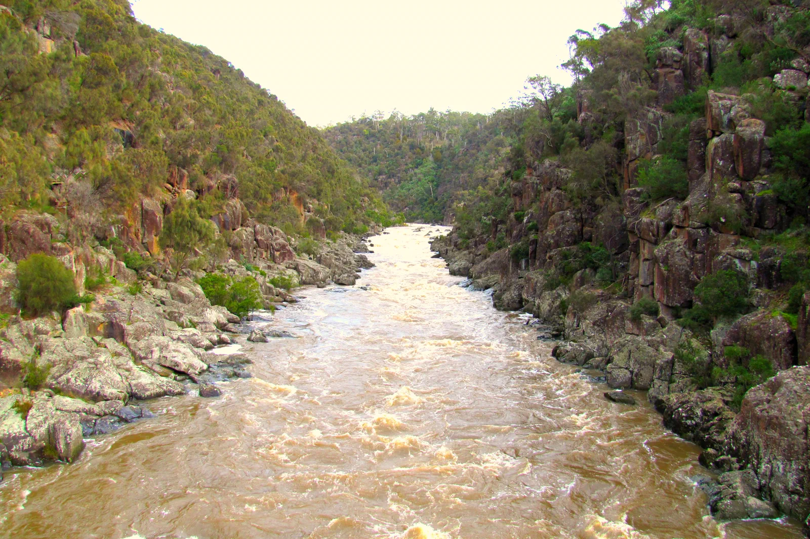
Launceston & Tamar Valley
A northern-city base joining Cataract Gorge, one urban collection and a short Tamar Valley line without turning producers into a driving marathon.
Open the field guide →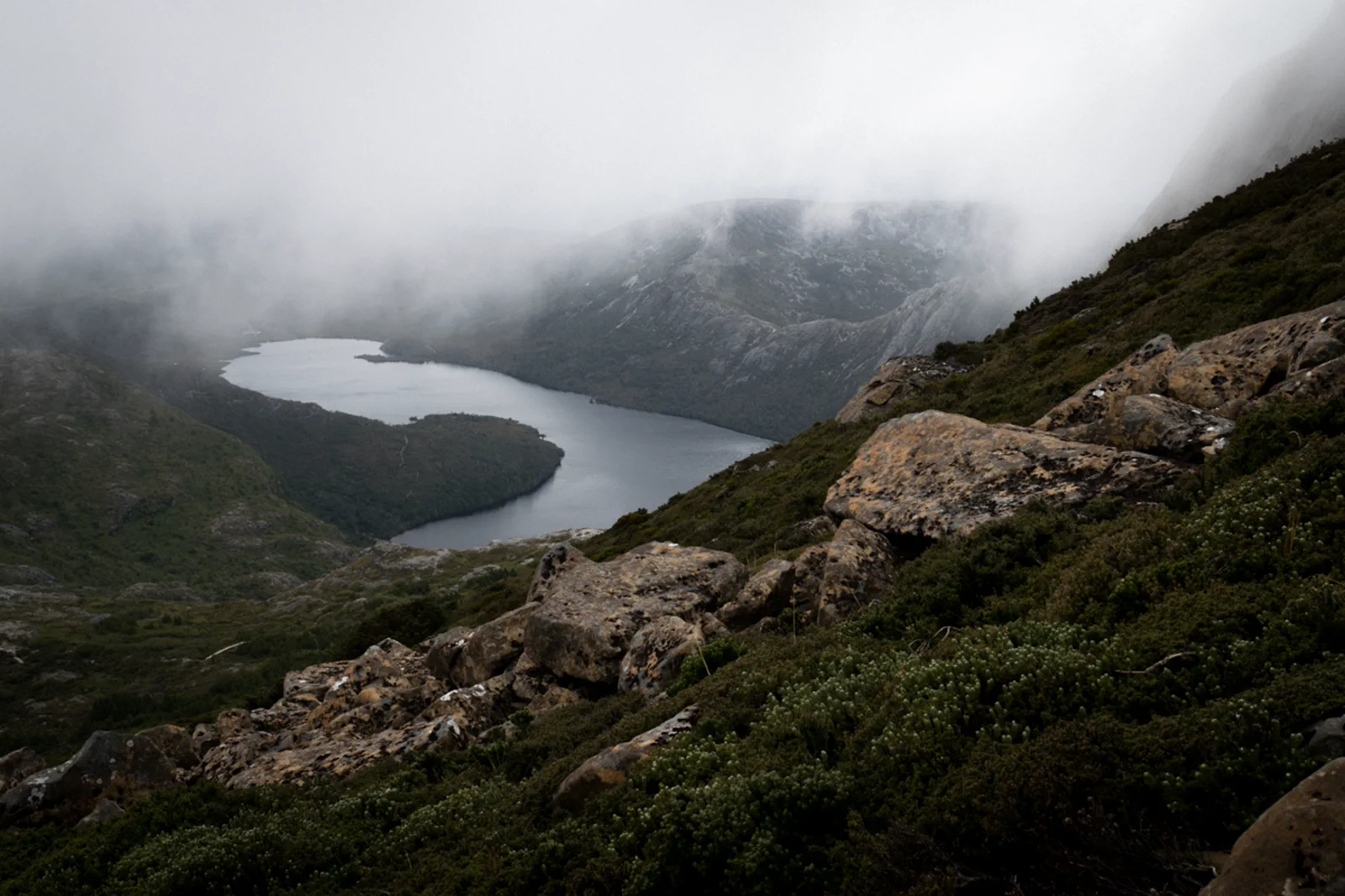
Cradle Mountain & Freycinet
A planning comparison between two distant national parks, each requiring its own gateway, shuttle or parking, weather and overnight.
Open the field guide →Distance is part of the content.
Australia punishes invisible transfer time. These five contracts keep the route honest.
Sleep near the first decision.
Planning estimate: three nights in Hobart support the southern city and one nearby decision; add a Tasman Peninsula night instead of forcing a dusk return. Launceston is a separate northern base, while Cradle Mountain and Freycinet each need their own gateway bed. A one-way route reduces backtracking only when the vehicle drop, luggage, check-in and next service are confirmed. Choose a Hobart start for the southern chapters, Devonport for the ferry arrival, or a Launceston start when the northern route is the real priority; moving hotels to a map midpoint rarely shortens both days. Do not use Hobart or Launceston as daily return bases for the whole island.
Name the road, rail, ferry or operator.
Fly to Hobart or Launceston, or reserve the Spirit of Tasmania crossing to Devonport with the correct vehicle dimensions and check-in. Compare a return hire-car loop with a one-way drop only after the supplier confirms the location, fee, hours and luggage plan; the ferry terminal is not a Hobart arrival point. Regional coaches connect some towns, but a town stop does not solve the trailhead, park shuttle, booked attraction or return. For each day, confirm the actual service, pickup, timetable, luggage rules and last departure; otherwise use a permitted hire car or a named operator. Drive in daylight with a conservative allowance for bends, wildlife, weather and road works. There is no assumed public through-service between these five chapters.
Permission and guidance come first.
Use recognised Traditional Owner language and visitor guidance. Do not infer access to cultural places, communities or Country from an online pin.
One national forecast is not enough.
Check the local fire, flood, surf, marine, alpine, heat or cyclone condition that actually governs the selected chapter.
Protect the last safe movement.
Every field guide declares a return, turnaround or overnight before adding optional distance.
Do not clear the map in one day.
nipaluna / Hobart & Salamanca
Start after checking TMAG’s current opening, entry, exhibition and accessibility information.
Field 02kunanyi / Mount Wellington
Take the highest safe objective early, use one lower track or visitor stop and descend before cloud or…
Field 03Port Arthur & Tasman Peninsula
Visit the historic site first, pause after difficult history, use one open national-park viewpoint and…
Field 04Launceston & Tamar Valley
Walk the gorge in suitable weather, cool inside, take one valley thread and return before rural darkness.
Field 05Cradle Mountain & Freycinet
Stay near the chosen park, start early, use one ability-matched walk and transfer to the other region…
A useful route depends on the number of days and the operating system.
These examples group real places and protect the return. Check live services, openings, access and weather before fixing the order.
southern base only
Sleep in central Hobart and choose the city route, kunanyi or the Tasman Peninsula as the main purpose. If the trip is a first visit, keep two city nights and add a third only for a confirmed nearby excursion or weather margin. Do not add Launceston, Cradle Mountain or Freycinet as same-day return legs. This shape suits a short leave window, a coach-based visit or uncertain mountain access; it trades island coverage for a realistic walk, booked entry and return.
south plus one northern gateway
Use a one-way sequence such as Hobart → a reserved Tasman Peninsula bed → Launceston, then choose either a Cradle Mountain stay or an east-coast stay. Protect the transfer day and do not stack Port Arthur, a long drive and an evening check-in. This can cover two or three systems well, but not every park. Pick the first fixed booking, then place nights around the next morning’s road; if weather closes the high country, stay at the gateway or switch only to an already confirmed lower-risk visit.
broad island circuit
Allow roughly two weeks for Hobart, the Peninsula, a northern city base, Cradle Mountain and the east coast, with separate beds and at least one flexible day. This is a planning estimate, not a fixed driving itinerary: reverse the order only after comparing current road conditions, ferry/flight direction, track access and lodging. Freycinet and Cradle are distant park areas and need their own nights; a same-day transfer between them is not a walk day. Remove a region before stretching each day when a closure or delay takes the buffer.
book the last mile first
Choose Hobart or Launceston as the base and use only dated coach, airport and tour legs that you can confirm end to end. Before paying, verify the stop near the lodging, luggage terms, activity pickup and return to the same gateway. A coach to a town is not a park shuttle. If a child chapter depends on an unconfirmed final ride, choose a city-based route instead of walking a highway shoulder or assuming rideshare coverage.
Tasmania FAQ
How many nights should I allow for Tasmania?
Three nights can support one southern base and a deliberate Hobart-area plan. Seven to nine nights can link the south with one northern gateway if you reserve each bed and protect road days. A broad Hobart–Peninsula–north–Cradle–east-coast circuit is roughly a two-week planning shape, plus weather margin; these are editorial estimates rather than measured drive times or operator guarantees.
Should I stay in Hobart or Launceston?
Choose Hobart for nipaluna, the harbour and southern access; choose Launceston for the northern city and Tamar Valley. Neither is a practical daily base for both Cradle Mountain and Freycinet. For a park-focused day, use the nearest confirmed gateway bed and move onward in daylight.
Can I do Tasmania by public transport?
Some towns connect by coach, but confirm every date-specific leg, stop, luggage rule and return with the operator. Park trailheads and local activities may require a separate shuttle, tour or vehicle. If that last mile is not confirmed, choose a destination served by a complete booked itinerary.
What if rain, fire or a road closure removes a park day?
Follow Parks Tasmania, Transport Tasmania, BOM and Tasmania Fire Service notices. Do not enter a closed track or find an informal bypass. If roads remain safe, stay at the current gateway, use a confirmed indoor town visit or move the park to a spare day; if an emergency warning applies, follow its instructions and cancel sightseeing.
Can I visit Cradle Mountain and Freycinet in the same day?
No useful walking plan treats them as one day. They are separate park areas with different gateways, parking or shuttle arrangements, track and weather checks. Book at least one overnight near each if both matter, and put the road transfer between the park days.
Does the ferry arrive in Hobart?
No. Spirit of Tasmania sails to Devonport. Plan the onward road or confirmed coach leg from Devonport before booking a Hobart hotel or a timed southern activity; check sailing, vehicle check-in and disruption terms directly with the operator.
Official sources and photo credits
Planning facts and image licenses were reviewed on 13 October 2026. Recheck transport, park, fire, weather, marine and operator conditions before travel.
- Discover Tasmania — official visitor planning and gateways.
- Parks and Wildlife Service Tasmania — current park alerts and track access.
- TasALERT — current emergency, road and community warnings.
- Transport Tasmania — public transport planning.
- Spirit of Tasmania — sailing, check-in, vehicle and disruption information.
- Bureau of Meteorology — Tasmania forecasts and warnings.
- Tasmania Fire Service — current fire danger and incidents.
- Tasmanian Aboriginal Centre — palawa culture and community-led information.
- Hobart waterfront Nov 2011 - 2.jpg — Tony 1212, CC BY 4.0. Resized, display-cropped and converted to WebP; no other material edits.
- Hobart, kunanyi, the river and Tasman Bridge from the Rosny Lookout.jpg — jacobharrisau, CC BY-SA 2.0. Resized, display-cropped and converted to WebP; no other material edits.
- THE HOSPITAL PORT ARTHUR HISTORIC SITE.jpg — JERRYE & ROY KLOTZ MD, CC BY-SA 3.0. Resized, display-cropped and converted to WebP; no other material edits.
- Launceston Cataract Gorge & First Basin, Tasmania.jpg — Feral Arts, CC BY 2.0. Resized, display-cropped and converted to WebP; no other material edits.
- Dove Lake view in a foggy day. Cradle Mountain Lake-St Clair National Park, Tasmania.jpg — Andrea.Messina93, CC BY-SA 4.0. Resized, display-cropped and converted to WebP; no other material edits.