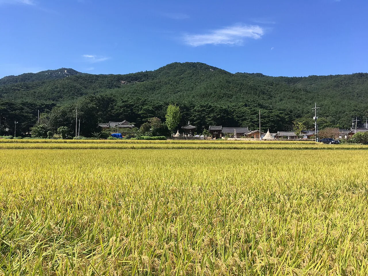
Namsan
Carved Buddhas, pagodas, tombs and temple sites are dispersed across a real mountain landscape. Start by choosing one documented route; “see Namsan” is not an itinerary.
Namsan quick facts
Choose a heritage walk or a mountain route
Official Gyeongju guidance describes both lower east-side heritage paths and west-side Samneung approaches. Their distance, elevation and exit logistics differ; never merge route fragments from different articles.
Dongnamsan heritage path
Use a lower path when the priority is a sequence of cultural remains, rural landscape and a half-day or carefully defined one-way walk. Confirm the current trail, finish point and return transport.
- History before summit.
- Still requires sun and rain protection.
- One-way routes need an exit plan.
Samneung and higher routes
Choose a documented mountain route when hiking fitness, elevation and uneven terrain fit the group. Do not treat a nearby trailhead as proof that every carved site is easy to reach.
- Footwear and turnaround time matter.
- Carry water and offline navigation.
- Weather can cancel the objective.
Six fields make one safe route
A useful trail note is more than a list of objects. Record the exact start, finish, surface, water, daylight and fallback that apply today.
01 · Route identity
Use the official name or map line, not a social caption such as “Namsan hike.”
02 · Start and finish
Confirm both trailheads and whether the route returns to the same transport point.
03 · Surface
Expect uneven stone, roots, steps and seasonal mud unless the exact route says otherwise.
04 · Water and food
Carry what the full route needs; a temple or village is not guaranteed to be a shop.
05 · Daylight
Set a turnaround for the descent, not the photographed object or summit.
06 · Fallback
Use a lower heritage path, museum or central walk when weather weakens the mountain plan.
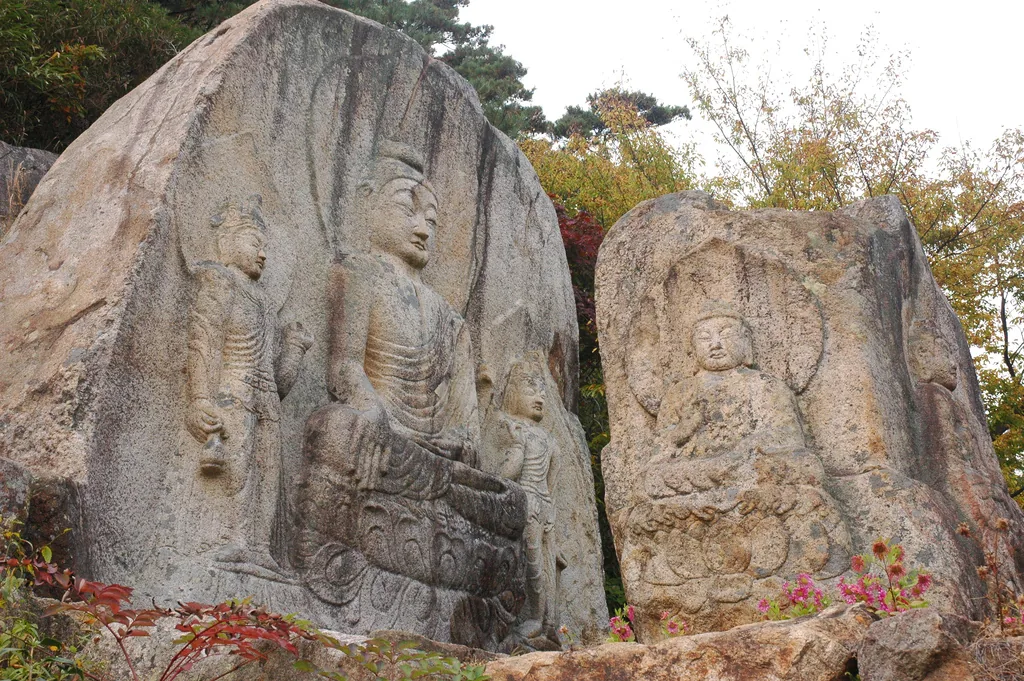
Distance is part of the meaning
UNESCO describes the Namsan Belt as a concentration of Buddhist monuments, rock carvings, pagodas, tombs and other evidence. Their dispersed setting is not permission to improvise access.
- Stay on marked paths and designated viewing surfaces.
- Never touch, trace, rub or wet a carving for contrast.
- Keep bags, poles and bodies away from stonework.
- Do not publish an off-trail shortcut as visitor advice.
Heritage interest does not lower the terrain
Heat, rain, ice, wind, poor footwear and a late start can turn a cultural walk into a rescue problem. Official alerts and closures are route decisions, not suggestions.
Carry
- Downloaded official map and charged phone.
- Water, food and any personal medication.
- Grippy footwear and weather layers.
- Basic light even for a planned daylight return.
Turn around when
- The route no longer matches the downloaded map.
- Thunder, heavy rain, ice or high heat develops.
- The slowest person reaches half of their safe energy.
- Remaining daylight no longer protects the descent.
Solve the exit before choosing the start
Different Namsan routes use different trailheads, villages and bus corridors. Confirm current service in both directions; a one-way heritage path can finish far from the place where the day began.
Public transport
Check the exact stop name in Korean, direction and final useful departure. Rural intervals deserve a generous margin.
Taxi
Keep the finish location ready in Korean and do not assume a remote pickup is immediate. Arrange one in advance when necessary.
Car
Parking at one trailhead does not solve a one-way finish. Never drive after alcohol and never block village or emergency access.
Gyeongju Namsan FAQ
Can I add Namsan after Bulguksa?
Not as a useful default. Bulguksa and Seokguram already create a separate mountain day, while Namsan requires another route, trailhead and safety plan. Give Namsan its own half or full day.
Is there one official Namsan trail map?
Gyeongju City and the relevant heritage or park authorities publish route material. Use the most current official map for the exact route, since a general city map is not sufficient navigation.
Can I cycle around Namsan?
Some official lower routes are described for walking or cycling, but that does not authorize bicycles on every mountain trail. Confirm the exact permitted path and yield to walkers and heritage boundaries.
What is the best bad-weather alternative?
Use the Gyeongju National Museum or a shorter central heritage walk when conditions remain safe. Move the mountain route rather than substituting a dangerous “quick trail.”
Choose formal temple, central ground or rest
Official sources and photo credits
Planning facts were reviewed on 26 August 2026. Recheck official maps, trail status, closures, weather and transport before departure. Images were converted to WebP for performance.
- UNESCO — Gyeongju Historic Areas and the Namsan Belt.
- Gyeongju City — Dongnamsan route guidance.
- Gyeongju City — Samneung and west-side route guidance.
- Gyeongju City — current Namsan area listing.
- Namsan and rice fields photo — Christophe95, CC BY-SA 4.0.
- Chilbulam carvings photo — rshe002, CC BY-SA 2.0.