West island follow the cooler edge
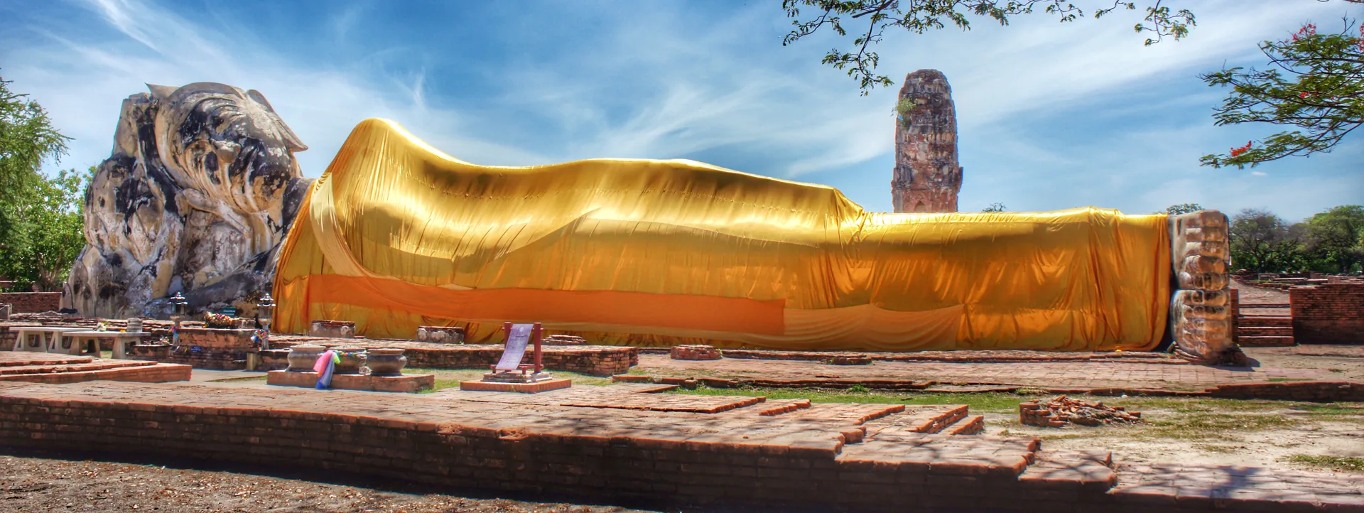
The western side rewards a different pace from the central ruin field. Open ground, local roads and the monumental reclining Buddha at Wat Lokayasutharam make temperature and distance part of the interpretation.
Four hours behave differently
Choose the route by sun and attention, not by the number of pins still visible.
Use long shadows
Begin with exposed monuments while roads and open ground are cooler. Confirm that current access supports the plan.
Stop the circuit
Move to lunch, a shaded rest or the museum. This is not wasted time; it protects the second half of the day.
Return with margin
Soft light is useful, but local transport and site closure matter more than a final photograph.
Walk the full length before framing the face
The reclining Buddha's scale is understood through distance and setting. Start from a respectful wide view, notice the surviving architectural traces around it, then approach only as current paths and worship activity allow.
Read the whole body
Use the lateral view to understand scale rather than beginning with a close facial crop.
Look for the vanished hall
Foundations and surrounding traces help explain why the outdoor image should not be imagined as originally isolated.
Keep feet and poses respectful
Do not climb, lean, mimic or turn a sacred image into a joke. Follow signs and give worshippers space.
Leave quietly
Check water, energy and the next distance before adding another exposed monument.
Choose wheels by skill and heat
Flat terrain can make cycling attractive, but road awareness, sun, rain, surface conditions and traffic still matter. Rent only a maintained bicycle and use a helmet where available; choose a driver when confidence or temperature makes cycling performative rather than practical.
Write a west-island loop
- Start and finish at named points, not “somewhere near the park.”
- Keep stops on the same side before crossing toward the west bank.
- Carry water and a sun/rain layer; shade is intermittent.
- Agree vehicle waiting and finish time before a late-afternoon stop.
Never leave an unprotected bicycle or valuables unattended because a site appears quiet.
West island without the collection impulse
Enter from the royal quarter
Finish the ceremonial core, pause, then move west only if temperature and attention remain good.
Wat Lokayasutharam
Give the image and surrounding foundations a complete visit instead of a roadside photograph.
Choose shade over another pin
Use food, water and quiet as a real itinerary block. Ruin fatigue makes every later structure look interchangeable.
Stay island-side or cross once
Return to accommodation, or continue to the west bank only when transport and current access are already settled.
West-island FAQ
Is Wat Lokayasutharam an active temple?
The site centers a sacred Buddha image within historic remains. Regardless of administrative category, behave as you would around a religious image and follow current local signs and worship activity.
Can I cycle there?
Yes when conditions, road skill and weather suit you. Inspect the bicycle, plan a same-side loop and choose motorized transport instead if heat or traffic reduces safety.
How long should the west island take?
Two to four unhurried hours can support one anchor and nearby context. It works best as a slower half-day, not as extra pins added after a full central circuit.
Should I continue to Wat Chaiwatthanaram?
Only when the west-bank transfer, current opening and return are already solved. It is a separate light-and-transport chapter, especially near evening.
Sunset bank, royal quarter or full atlas?
Official sources and photo credit
Reviewed 26 August 2026. Site access, local roads and transport arrangements can change. Image was resized and converted to WebP; visible framing may crop the display.
- Fine Arts Department - Ayutthaya Historical Park.
- Tourism Authority of Thailand - Ayutthaya.
- Wat Lokayasutharam - Nayika C., CC BY-SA 3.0; resized and converted to WebP, display crop.