Otaru & Shakotan
One is a rail-friendly port city; the other is a weather-exposed peninsula. Enjoy Otaru at walking pace, then earn the coast with a transport plan that matches the season.
Otaru and Shakotan quick facts
Reach Otaru easily; prove Shakotan separately
JR Hokkaido connects Sapporo and Otaru on a practical corridor. Beyond Otaru, frequency falls and the coastline becomes seasonal: confirm the operator, reservation rules, last return and walking access for your travel date.
Sapporo → Otaru
Rail is the clean default. Check the exact service and seat type, then begin the day from Otaru Station rather than transferring to a local bus without need.
Otaru → Shakotan
Public buses can serve parts of the peninsula, but availability and useful turnaround times vary. Save the current timetable offline before departure.
Rental car
A car improves coastal flexibility in the open season. It does not cancel fog, wind, closures, narrow roads or the need to stop before fatigue.
Move downhill, then choose one deep interest
Otaru Station sits above the waterfront. Use that geography: descend toward the port, cross the canal once and avoid bouncing between the same retail blocks.
Station → market choice → canal → warehouse slope
Station overlook
Confirm the return train, orient toward the water and resist the urge to start with a long detour in the opposite direction.
Market or heritage
Choose one: a seafood-focused stop, a museum or port-history block. A market is not compulsory if breakfast is already done.
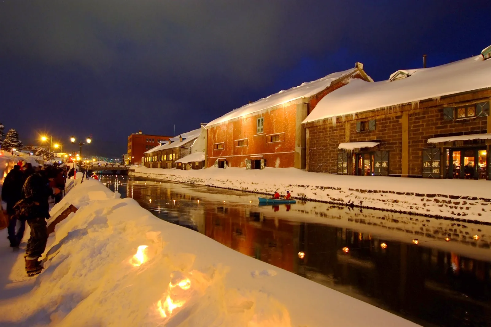
Canal and warehouses
Walk the canal as a connective landscape, then continue instead of waiting for the same viewpoint to become empty.
Sakaimachi and craft
Pick glass, music boxes, architecture or a café with intent. Return by the most useful station-side route.
Build Shakotan around the last return
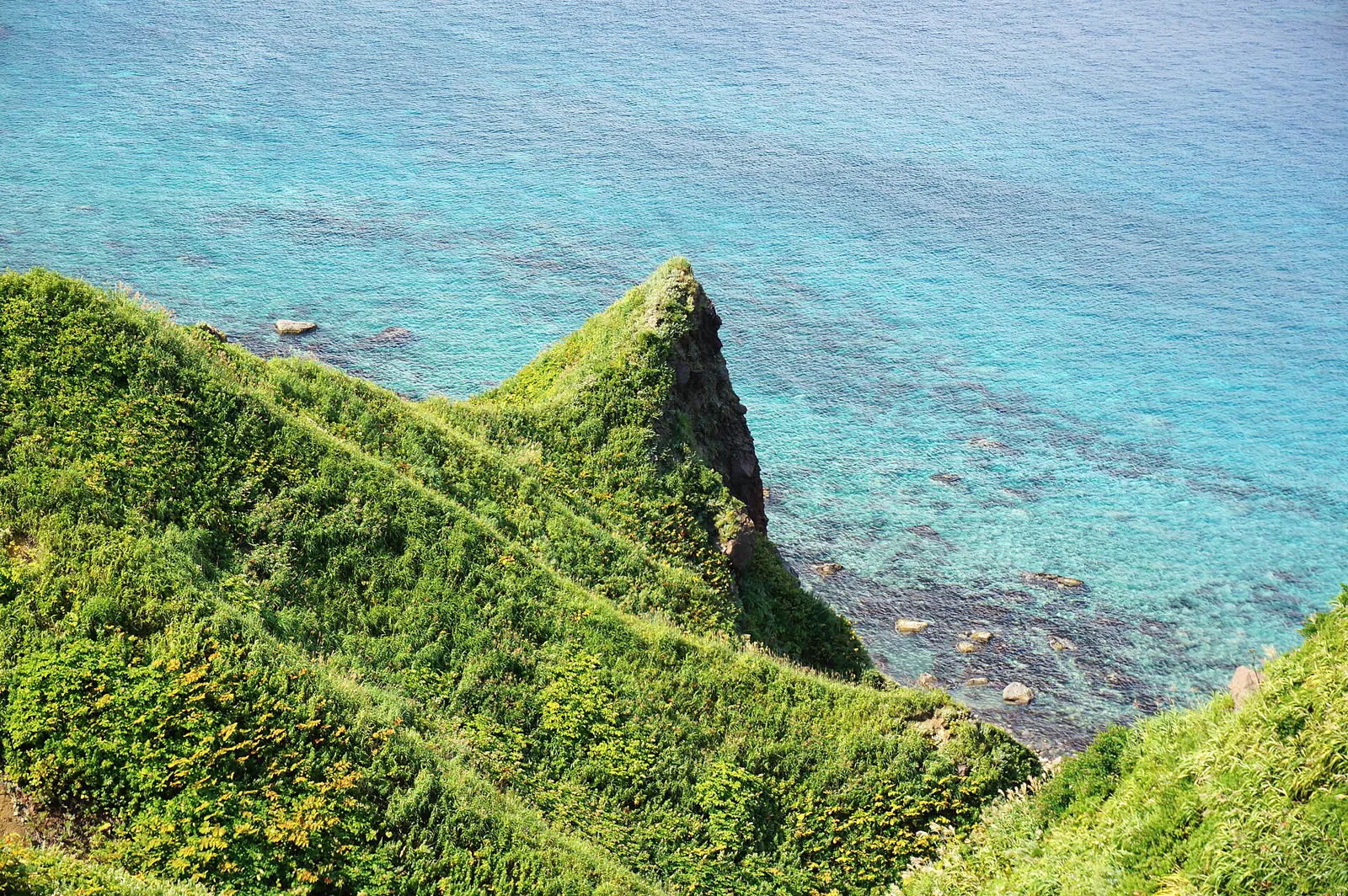
Cape Kamui and the blue coast are exposed landscapes. Paths can close, buses can be sparse and sea conditions can erase a boat plan. Start with the transport window, then choose one coastal goal.
- Confirm whether the cape path is open.
- Check wind, rain and visibility before committing.
- Never climb barriers for a clearer photograph.
- Keep food, fuel and a warm layer in the plan.
Day trip for efficiency, overnight for atmosphere
Otaru works from Sapporo, but its evening canal and early streets feel different after the day-trip wave. An overnight also improves onward travel toward Yoichi, Niseko or Shakotan.
Stay in Sapporo if…
- Otaru is the only west-coast objective.
- You have a fixed early flight or long-distance train next.
- Broad dinner choice matters more than port atmosphere.
- You want one simple rail day without moving luggage.
Stay in Otaru if…
- Blue-hour or early canal light is a priority.
- You want a slower museum and architecture day.
- Yoichi, Niseko or Shakotan follows.
- A ryokan or port-side evening is part of the trip.
Let weather change the page, not ruin the day
Otaru remains a city destination in poor weather; Shakotan is far more exposed. Keep an indoor Otaru version ready and do not force the peninsula when visibility or access collapses.
Snow narrows the street
Allow extra walking time, wear grip and avoid stepping into the roadway around snowbanks for a photograph.
Demand follows clear days
Popular seafood and coastal transport can fill. Reserve only what is date-critical and keep a fallback return.
Quiet can mean closed
Verify boats, visitor facilities, buses and walking routes; do not infer availability from a summer review.
Otaru and Shakotan FAQ
Is Otaru an easy day trip from Sapporo?
Yes. The rail corridor makes a six-to-eight-hour port visit practical. Stay overnight only when atmosphere, a slower pace or westward onward travel justifies it.
Can I add Shakotan to an Otaru day?
Only when current transport and weather support a limited plan. The peninsula is not a guaranteed year-round connection, and a rushed combined day often underserves both places.
Is the canal enough for Otaru?
No. It is the visual hinge of the port, but architecture, craft, food and the station-to-water geography give the city its depth.
Do I need a car for Shakotan?
A car improves flexibility in the suitable season, but some public access exists. Compare the current bus, walking window and last return; never drive winter coastal roads casually.
Keep the coast coherent
Official sources and photo credits
Planning facts were reviewed on 26 August 2026. Recheck trains, buses, path status, weather, boat operations and seasonal opening before travel.
- Otaru Tourism Association — English guide map.
- JR Hokkaido — official English site.
- JNTO — Shakotan.
- Otaru Canal photo — t-konno, CC BY-SA 3.0.
- Cape Kamui photo — 663highland, CC BY 2.5.