Da Nang & Hoi An Split the coast by tide, temple and town.
Da Nang and Hoi An share an airport corridor but not one travel rhythm. Keep the city beach, Son Tra forest, limestone shrines, living old town and inland Cham sanctuary as separate chapters with their own access, conduct and weather decisions.
- Useful stay
- Use Da Nang for beach, city and Son Tra access; use Hoi An when the old town, countryside or evening heritage rhythm…
- Transfer logic
- Build from the Da Nang airport and city road network, then protect the longer Hoi An and My Son legs with daylight…
Open the place at the right scale.
Each card solves a different transport, access or conduct problem. None is a placeholder.
01Han River & Da Nang City Core
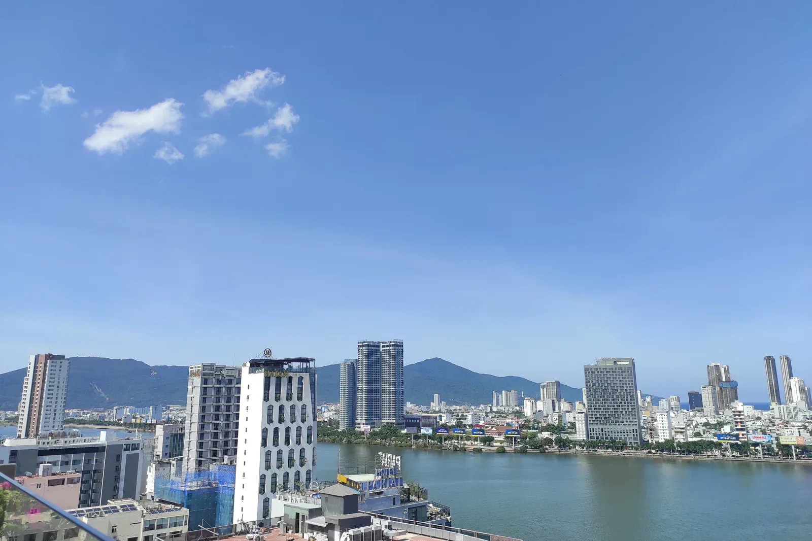
Build a walkable Da Nang day around the Han River, bridges, Cham sculpture and everyday waterfront life instead of a list of photo stops.
Open the field guide →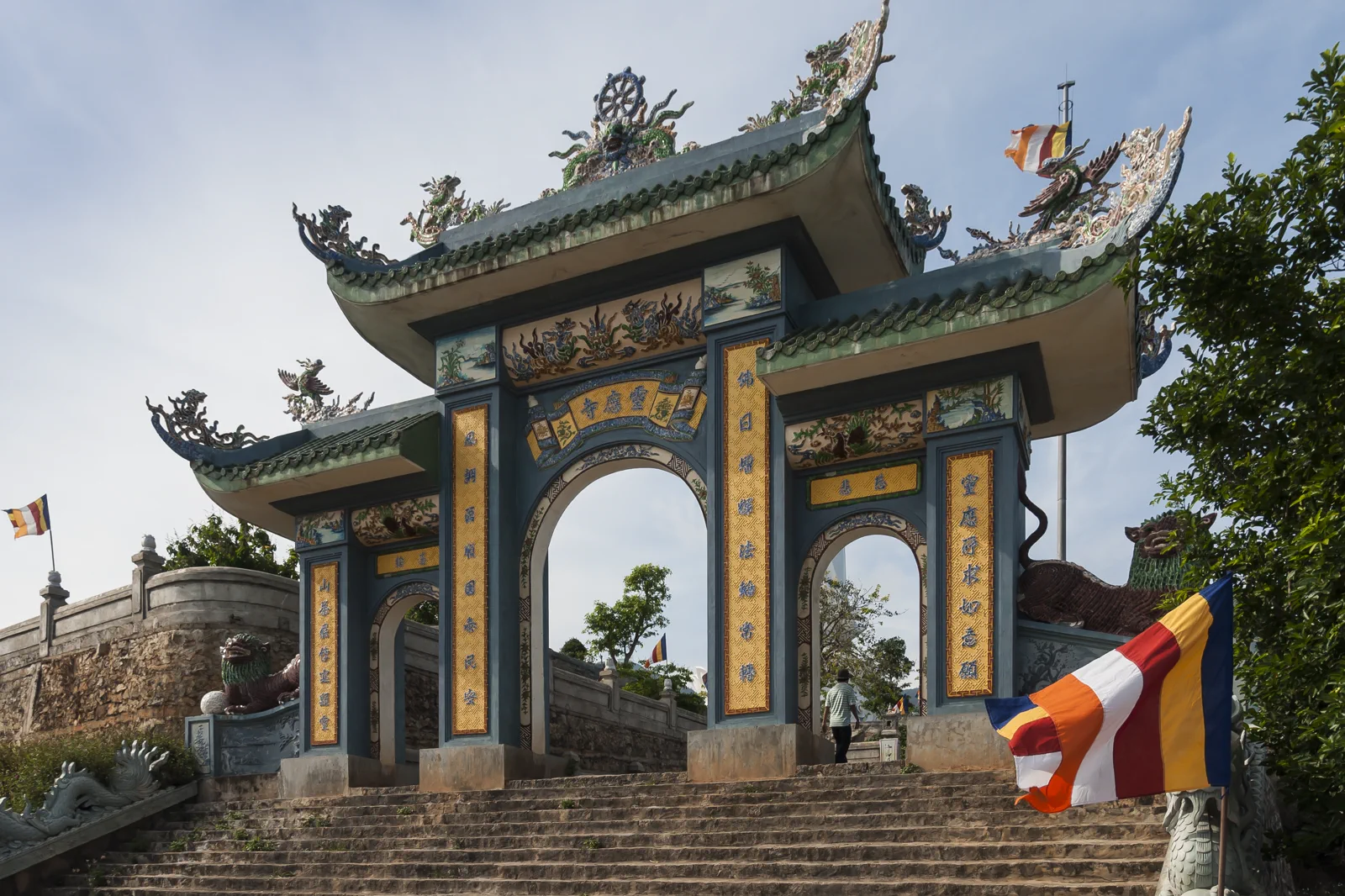 02
02Son Tra Peninsula Wildlife & Linh Ung
Plan Son Tra as a forest and wildlife route with Linh Ung, viewpoints and red-shanked douc langur ethics at its center.
Open the field guide →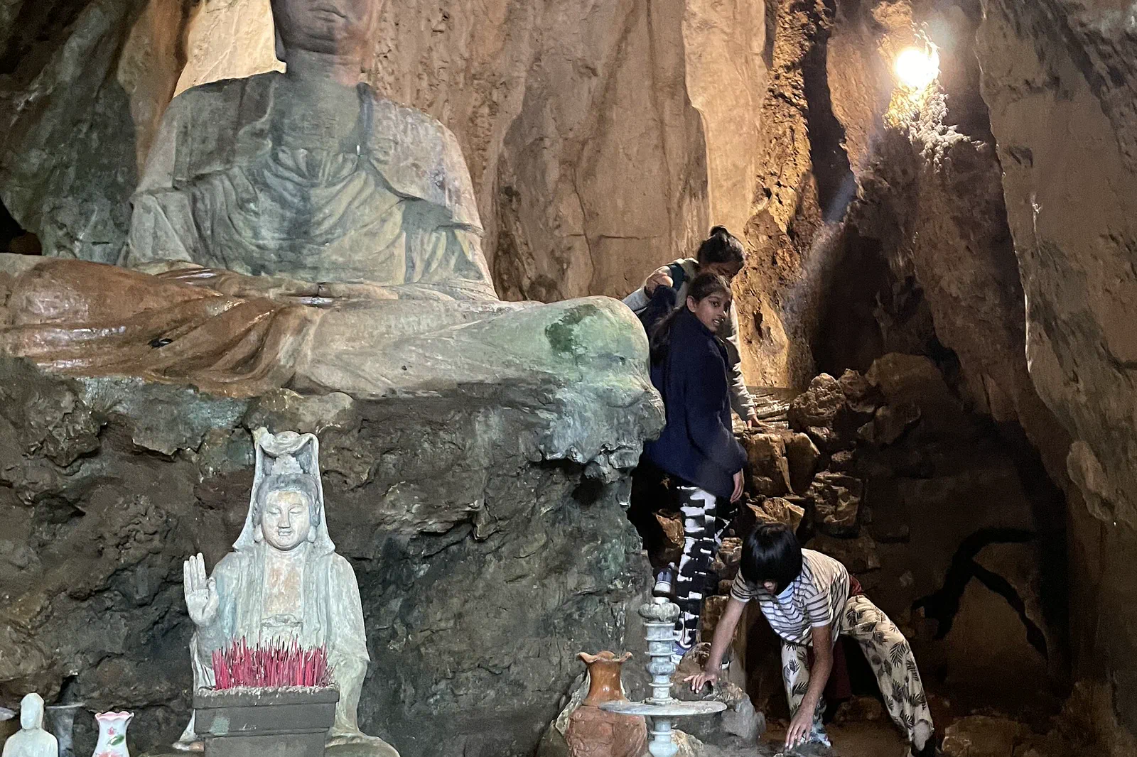 03
03Marble Mountains & Non Nuoc
Read the Marble Mountains through limestone, cave light, active worship and Non Nuoc craft rather than treating the site as a quick staircase.
Open the field guide →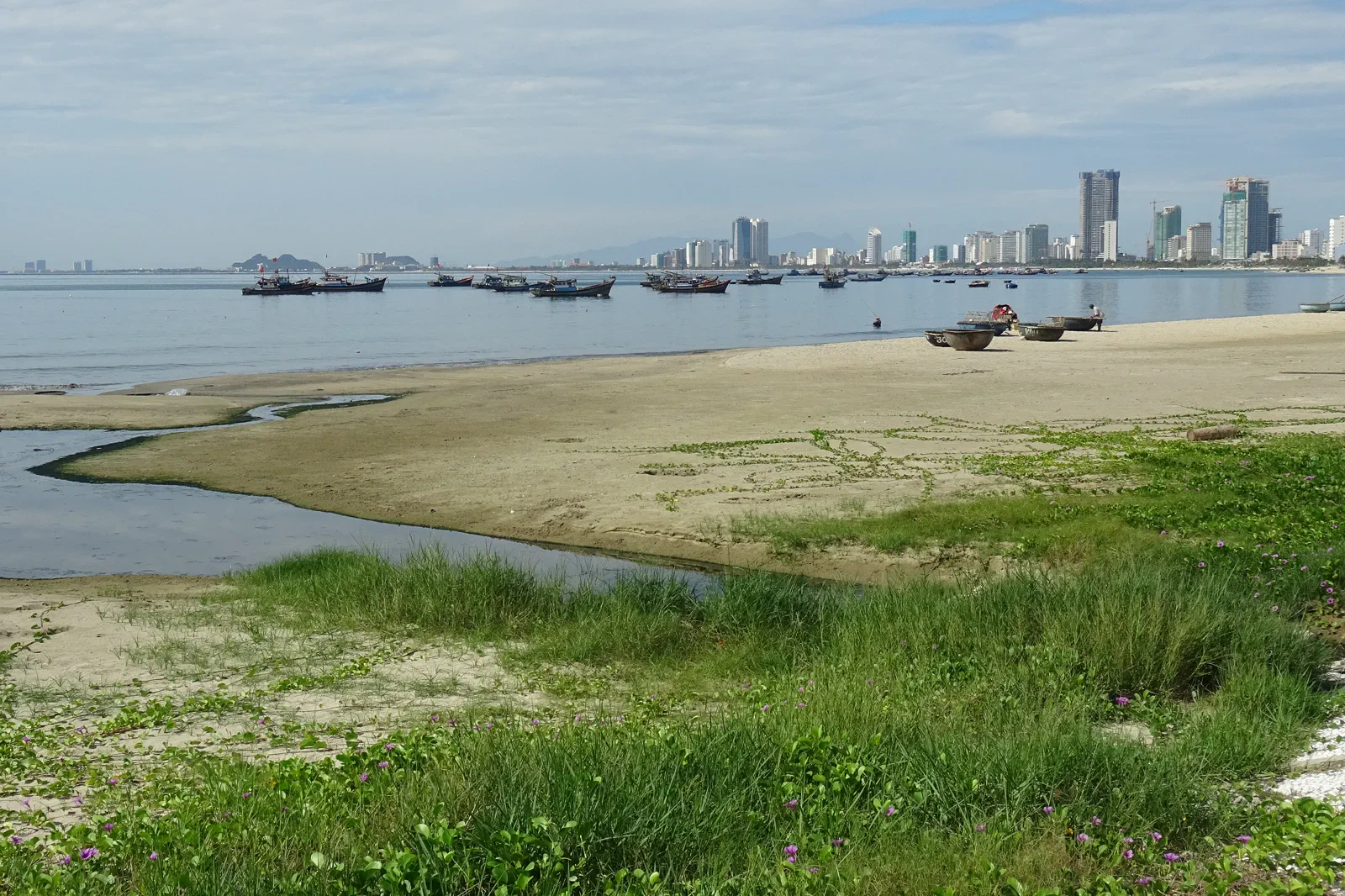 04
04My Khe Beach & An Thuong
Use My Khe and An Thuong for a practical beach-and-city chapter focused on sunrise, swimming conditions, food and local public space.
Open the field guide →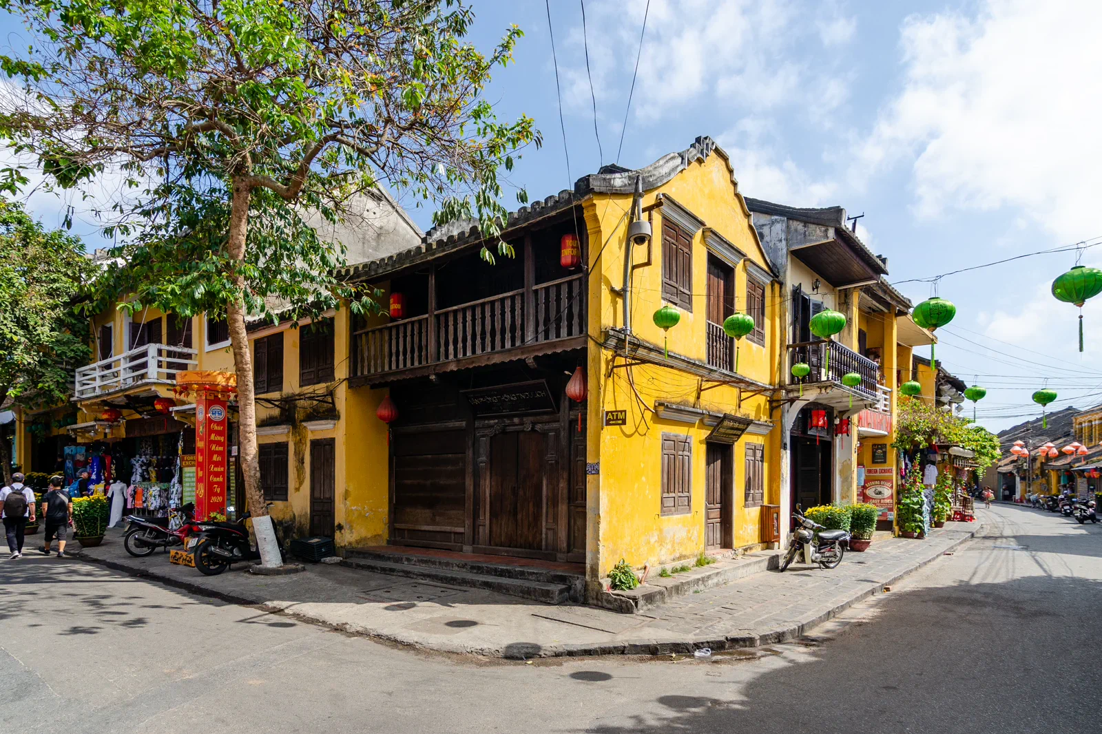 05
05Hoi An Ancient Town
Plan Hoi An as a living World Heritage town of houses, river trade, worship and residents, with entry rules and flood weather built into the walk.
Open the field guide →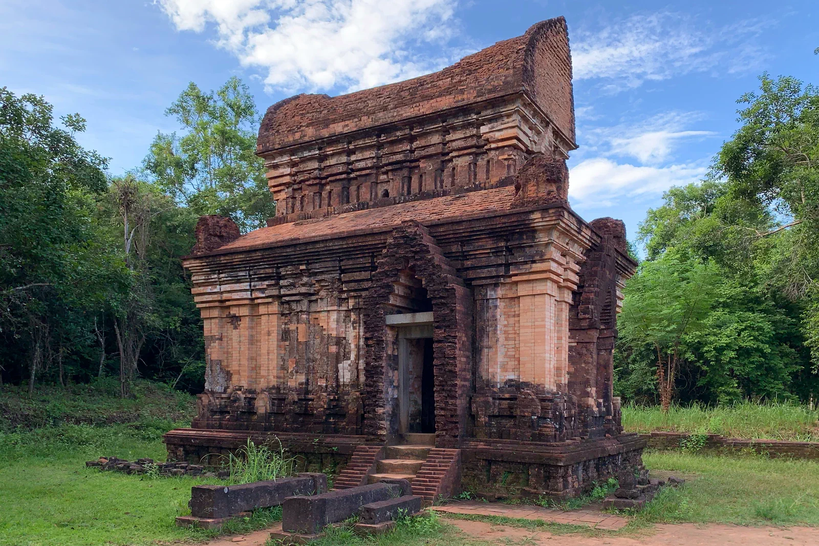 06
06My Son Sanctuary & Cham Heritage
Make My Son an early, respectful inland heritage journey through Cham architecture, valley ecology, conservation and marked visitor routes.
Open the field guide →Six chapters, six different conditions.
Distance, weather, sacred space, working neighborhoods and protected landscapes cannot share one generic checklist.
Han River & Da Nang City Core
Use the airport, central hotels and ride-hailing network as practical anchors. Crossing roads, bridge traffic and event controls can matter more than the nominal distance between points.
Keep the boundaryProtect the river and collections: stay behind barriers, follow museum photography rules, keep clear of traffic and do not treat local people as background props.Son Tra Peninsula Wildlife & Linh Ung
Use a roadworthy vehicle, helmet and a driver comfortable with winding mountain roads. Some roads, viewpoints and access arrangements can be restricted by weather or local management.
Keep the boundaryProtect the douc langur habitat: no feeding, chasing, calling, touching, flash photography, drones or off-road approach; carry all waste back down.Marble Mountains & Non Nuoc
A short taxi or ride from Da Nang is practical, but the final visit is on foot with stairs and uneven rock. Check current entrances, elevator availability and permitted areas.
Keep the boundaryProtect cave, temple and craft boundaries: no touching carvings, climbing shrine structures, collecting stone or entering workshops and homes without invitation.My Khe Beach & An Thuong
The coast is easy to reach from central Da Nang, but road crossings, parking, heat and peak beach density can make the last few blocks slower than expected.
Keep the boundaryProtect swimmers, fishermen and the public shore: obey flags and lifeguards, avoid restricted water, keep noise reasonable and leave sand, drains and streets clean.Hoi An Ancient Town
Reach Hoi An by road from Da Nang or another regional base, then walk or cycle inside the appropriate pedestrian zone. Entry points, ticket validity and vehicle restrictions can change.
Keep the boundaryProtect the living heritage boundary: follow ticket and building rules, do not touch timber or altars, ask residents before photographing and keep doorways clear.My Son Sanctuary & Cham Heritage
Travel by confirmed car or regulated excursion from Hoi An or Da Nang. The inland approach, heat and return distance make a late departure a poor default.
Keep the boundaryProtect the sanctuary and buffer: never climb or touch towers, leave marked paths, do not disturb soil or artifacts, and treat unexploded-ordnance warnings as absolute.Protect the transfer before adding the view.
This is an editorial sequence, not a promise that every activity operates every day.
Han River & Da Nang City Core
Start with daylight on one riverbank, move through one museum or civic layer, pause for food, then return to the water after dark only where pedestrian access is clear.
Chapter 02Son Tra Peninsula Wildlife & Linh Ung
Climb with a weather check, visit the pagoda respectfully, scan the forest from legal viewpoints, then descend before rain, darkness or fatigue changes the road risk.
Chapter 03Marble Mountains & Non Nuoc
Arrive before the hottest crowd period, climb slowly, move through caves and shrines with quiet attention, then descend to the craft and neighborhood layer without blocking workshops.
Chapter 04My Khe Beach & An Thuong
Check the beach flags, walk the public edge, choose a supervised swim zone if conditions allow, then move inland to An Thuong for food without carrying wet beach behavior into local businesses.
Chapter 05Hoi An Ancient Town
Begin in daylight with a heritage building sequence, pause away from the busiest lanes, then return for the lantern atmosphere only after checking rain, water level and crowd movement.
Chapter 06My Son Sanctuary & Cham Heritage
Reach the visitor entrance early, follow the permitted shuttle or path, read the main groups in sequence, then return by the marked route without entering forest or unpresented archaeology.
Da Nang & Hoi An FAQ
How much time should Han River & Da Nang City Core receive?
Use a half day for a compact river and culture walk, or a full day when the group wants separate daylight and evening readings.
How much time should Son Tra Peninsula Wildlife & Linh Ung receive?
Allow most of a day for a careful peninsula circuit; a short city stop is not enough to justify a rushed summit drive.
How much time should Marble Mountains & Non Nuoc receive?
Use a focused half day with time for recovery; visitors with limited mobility should verify accessible sections before arrival.
How much time should My Khe Beach & An Thuong receive?
A half day works for beach and food; a full day should include a real midday recovery rather than continuous sun exposure.
How much time should Hoi An Ancient Town receive?
Give the old town one full daylight-to-evening arc, or split it into two shorter visits when heat, mobility or rain is a concern.
How much time should My Son Sanctuary & Cham Heritage receive?
Use most of a half day plus road margin; a full day is reasonable when paired with a carefully chosen Cham museum or local food stop.
Official sources and photo credits
Planning facts and image licenses were reviewed on 31 August 2026. Recheck transport, entry, weather, park and operator conditions before travel.
- Vietnam Tourism — Da Nang transport, beach, Son Tra and Marble Mountains.
- UNESCO — Hoi An Ancient Town.
- UNESCO — My Son Sanctuary.
- Hoi An World Cultural Heritage Conservation Center — visitor announcement.
- Da Nang Tourism — Son Tra Peninsula.
- Han River, Da Nang — Somerset999, CC BY-SA 4.0. Resized, display-cropped and converted to WebP; no other material edits.
- Gate to Linh Ung Pagoda, Son Tra Peninsula — CEphoto, Uwe Aranas, CC BY-SA 3.0. Resized, display-cropped and converted to WebP; no other material edits.
- Marble Mountains, Ngu Hanh Son — Muralikrishna m, CC BY-SA 4.0. Resized, display-cropped and converted to WebP; no other material edits.
- My Khe Beach, Da Nang — Christophe95, CC BY-SA 4.0. Resized, display-cropped and converted to WebP; no other material edits.
- Hoi An Ancient Town — Steffen Schmitz, CC BY-SA 4.0. Resized, display-cropped and converted to WebP; no other material edits.
- My Son Sanctuary Temple E7 — Chainwit., CC BY 4.0. Resized, display-cropped and converted to WebP; no other material edits.