Brisbane & Moreton Bay Choose a river day or one island operating system at a time.
Brisbane’s river makes a compact city day; the bay islands begin separate ferry, road and weather plans. CityCats join public river terminals, Cleveland ferries serve Minjerribah, and Mulgumpin’s park tracks require a different crossing and access plan. Use the nights you have to choose one route at a time, protect the return, and leave room for Quandamooka Country and changing park conditions.
- Useful stay
- For a first city visit, compare the CBD near a rail interchange with South Brisbane by your arrival, first route and late return.
- Transfer logic
- City ferries, Cleveland island ferries, island buses and Mulgumpin vehicle or resort services are separate plans; confirm each operator and leg.
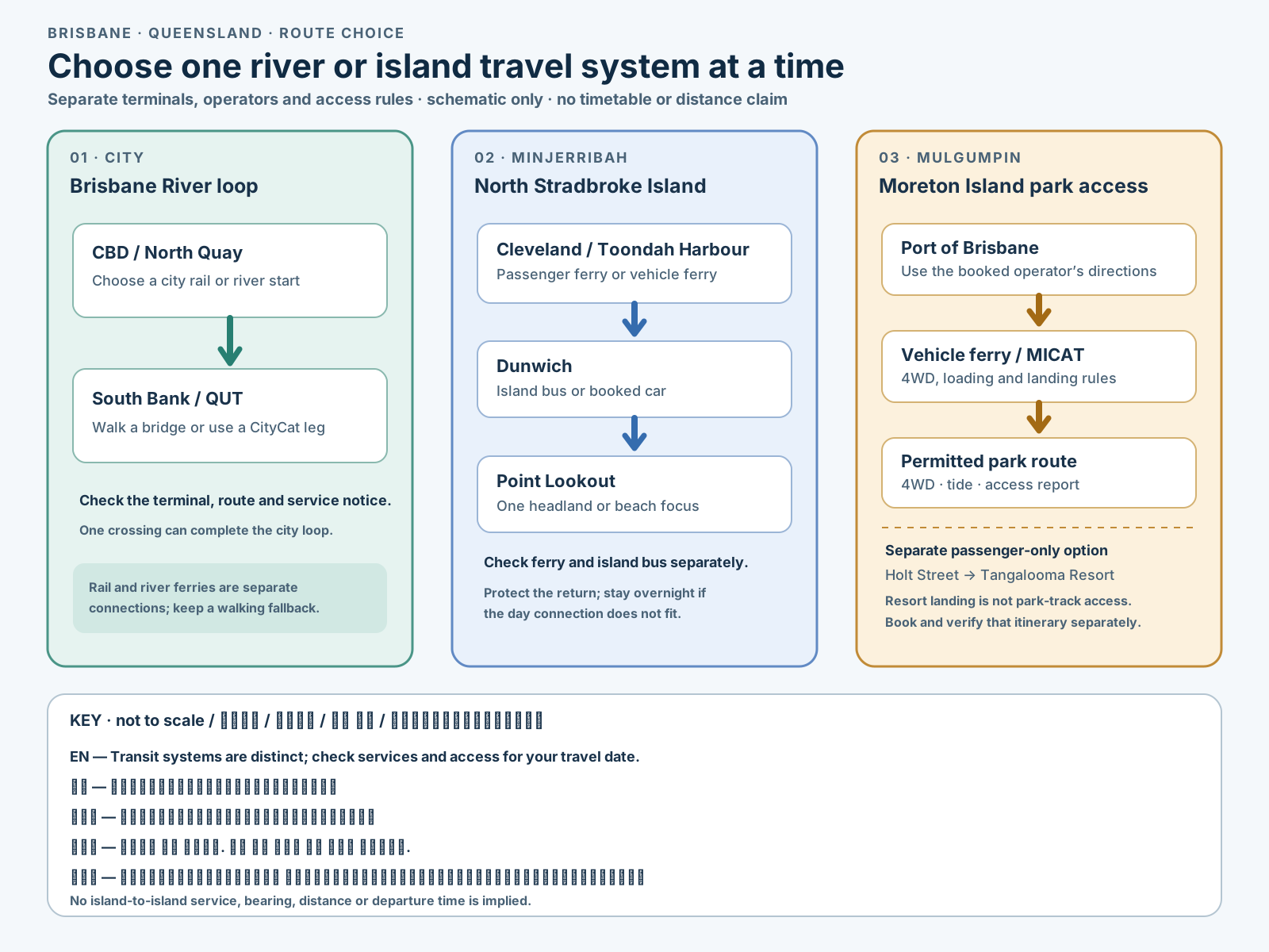
Choose the operating system, then the place.
Every card opens a full route with transport, access, weak points, official sources and visible image provenance.
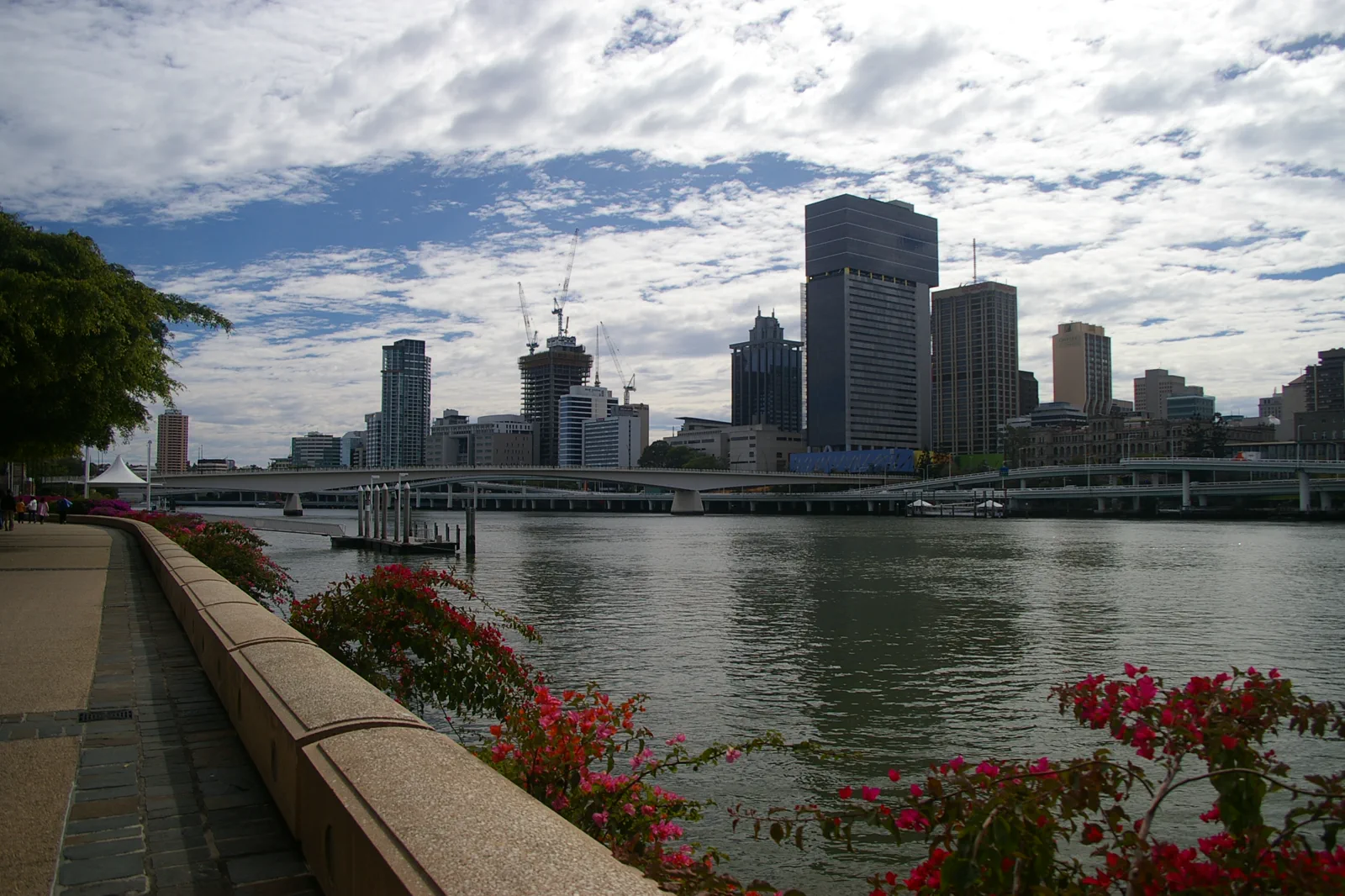
City River & South Bank
A central Brisbane loop that alternates shaded cultural interiors, river crossings and ferry segments instead of tracing every bend on foot.
Open the field guide →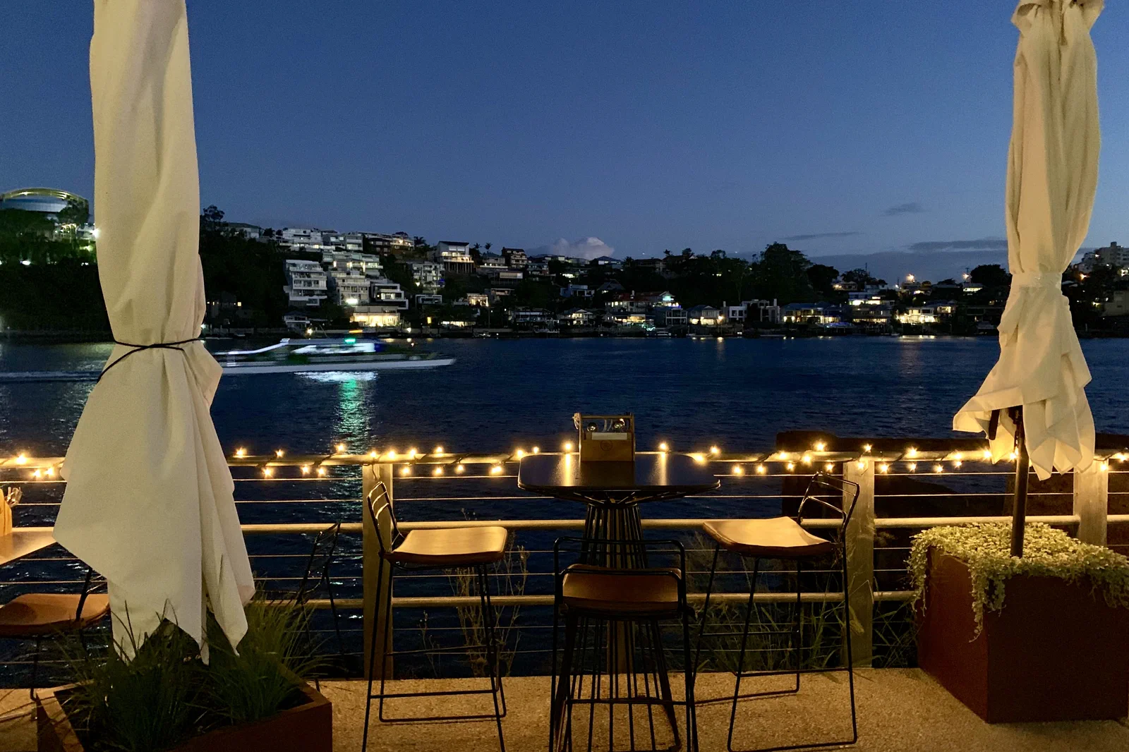
New Farm & Fortitude Valley
A neighborhood chapter moving from river park and arts space into the Valley’s evening economy with a deliberate late return.
Open the field guide →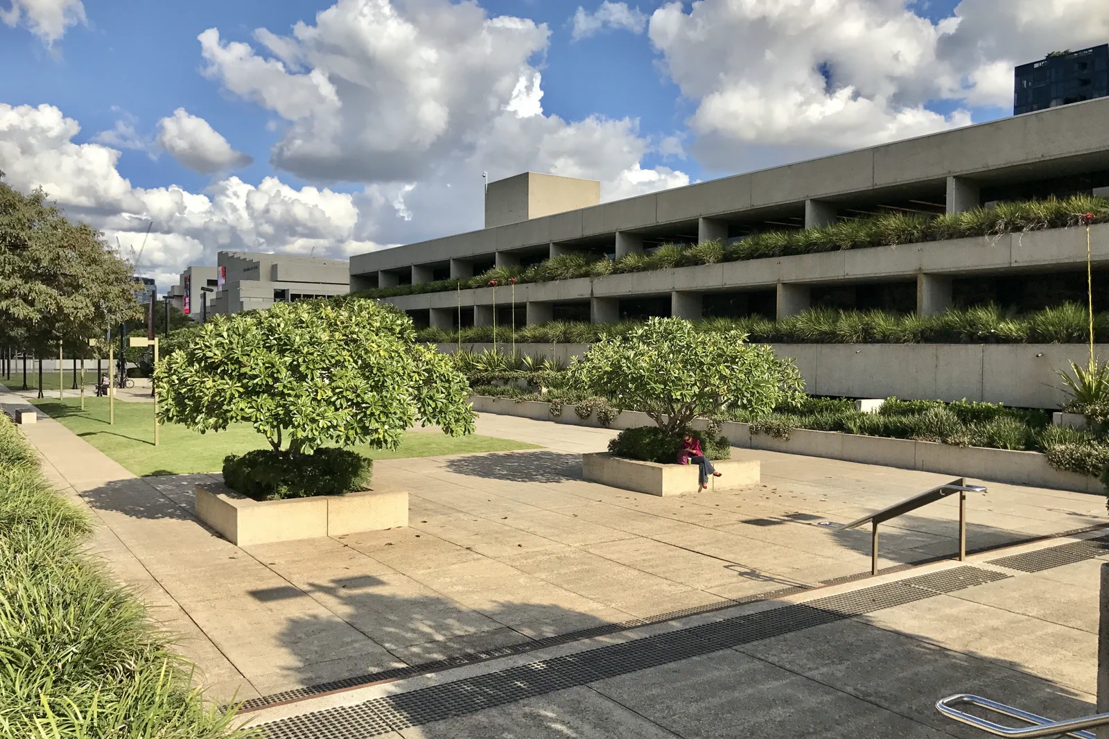
West End & Cultural Precinct
A culture-and-food route joining major institutions with West End while keeping exhibition time, market calendars and residential streets distinct.
Open the field guide →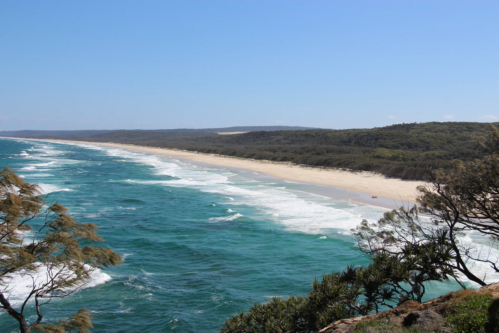
Minjerribah / North Stradbroke Island
An island route that names mainland terminal, passenger or vehicle ferry, island bus and Quandamooka Country responsibilities before the beach.
Open the field guide →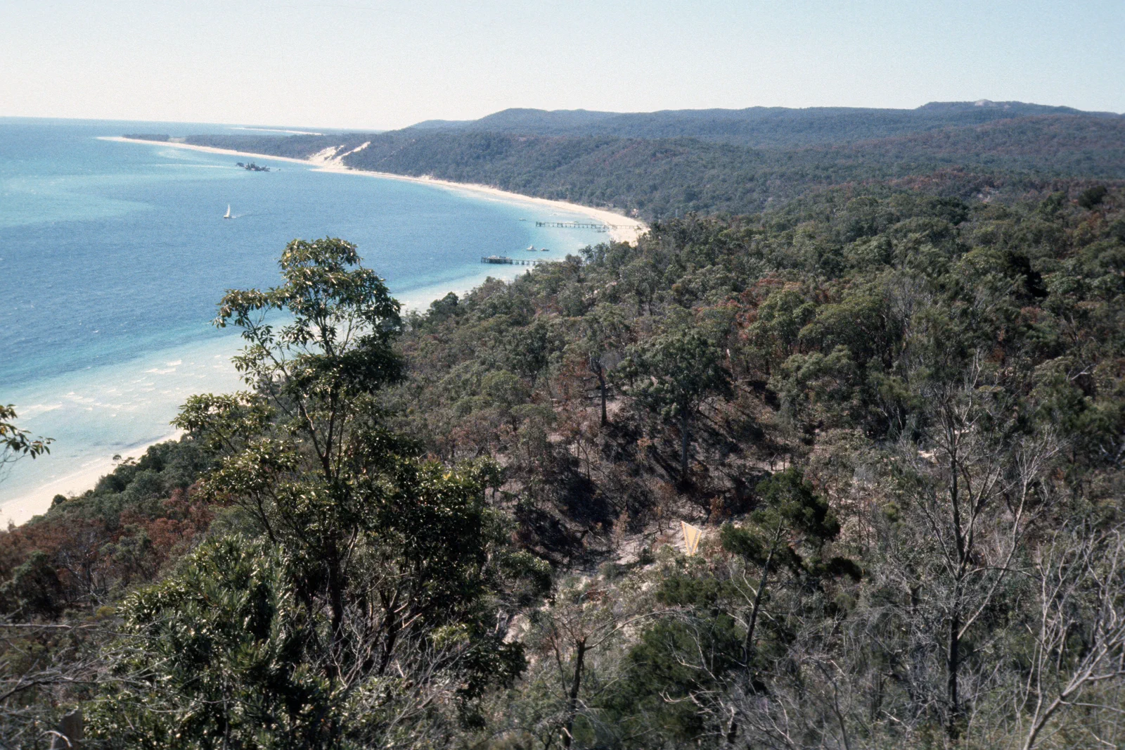
Mulgumpin / Moreton Island
A sand-island expedition requiring a named ferry or licensed tour, capable vehicle planning, camping controls and honest weather limits.
Open the field guide →Choose a base for the first transfer, not the map pin.
CBD, Central or South Brisbane
For a short stay, prioritize a walkable rail stop and the first planned route. The CBD suits a rail-led arrival and a river loop; South Brisbane places the cultural precinct closer. Check the exact hotel entrance, luggage path, station lifts and night return instead of assuming two central addresses are interchangeable.
Keep each island as its own booking
For Minjerribah, compare Dunwich near the ferry landing with Point Lookout near a chosen headland or beach. On Mulgumpin, match a permitted campground or accommodation to the vehicle-ferry landing; Tangalooma is a separate resort stay. Changing bases can cost another ferry leg, so add an island night only when it buys the time you need.
Confirm the return before the outward leg
Use Brisbane City Council and Translink for river routes, and the selected island ferry and bus operators for their own live schedules. A ferry booking does not reserve a bus, park track or activity. Do not build a close connection across different operators without a workable margin and a later alternative.
Permission and guidance come first
Minjerribah and Mulgumpin are Quandamooka Country. Follow public cultural guidance, park notices, camping and vehicle permits, beach rules and closed-area signs. Check local forecast and marine warnings for the actual island; a city forecast cannot clear a ferry, beach or sand track.
Do not clear the map in one day.
Brisbane’s compact centre and its island systems reward different paces. Keep one main travel system per day and treat an island return as a real itinerary boundary.
CBD → South Bank → one river crossing
Allow half a day for the riverfront loop, longer if one gallery or museum is the anchor. A CityCat segment is optional; walking and rail alternatives keep the plan usable if the river service changes.
Cleveland → Dunwich → one island focus
Choose a passenger or vehicle ferry before setting the route. A bus-led Point Lookout visit needs a checked island timetable and a return margin; stay overnight if a day connection is too tight.
One booked access model → one main objective
Choose permitted 4WD access and park camping, or book a guided trip, or stay at the separate passenger-ferry resort. These are different landings and products; do not join them into one promised circuit.
Brisbane & Moreton Bay FAQ
How many nights should I plan for Brisbane and the bay?
Three nights suit the city and one carefully selected island day. Five nights allow two distinct island chapters with a city day. Seven nights add an overnight island stay or a weather reserve; do not put both islands on the same day.
Where is the most useful Brisbane base?
Compare the CBD near a rail interchange with South Brisbane near the cultural precinct. Choose by your first route, luggage arrival and late return; an island overnight can replace repeated mainland travel.
Can I visit Minjerribah and Mulgumpin as one island day?
No. Their mainland terminals, ferry arrangements and island transport are separate. Give each its own day or overnight plan and check the booked return before you commit.
What should I verify on the travel date?
Check Translink and CityCat service notices for the city, the chosen ferry and island-bus operator, Queensland Parks access and permits, and Bureau of Meteorology warnings. A route diagram does not confirm a sailing or open track.
Official sources and photo credits
Route and access facts were checked on 12 October 2026. Photo source pages and displayed license credits are recorded separately from route research; this is not an independent rights clearance. Recheck transport, park, fire, weather, marine and operator conditions before travel.
- Tourism Australia — Brisbane.
- Brisbane Economic Development Agency — visitor guide.
- Translink Queensland — service planning and alerts.
- Queensland Parks — Minjerribah protected areas.
- Queensland Parks — Gheebulum Kunungai (Moreton Island).
- Brisbane River and skyline from South Bank Brisbane IMGP6207.jpg — John Robert McPherson, CC BY-SA 4.0. Resized, display-cropped and converted to WebP; no other material edits.
- Norman Park seen across Brisbane River from New Farm, Queensland.jpg — Kgbo, CC BY-SA 4.0. Resized, display-cropped and converted to WebP; no other material edits.
- Queensland Art Gallery, Brisbane river facade.jpg — Kgbo, CC BY-SA 4.0. Resized, display-cropped and converted to WebP; no other material edits.
- View of Main Beach from Point Lookout (North Stradbroke Island).JPG — S. Newrick, CC BY-SA 4.0. Resized, display-cropped and converted to WebP; no other material edits.
- Tangalooma beach, Mulgumpin, (Moreton Island) mid-1970s QUT-484.jpg — Iraphne R. Childs, CC BY 4.0. Resized, display-cropped and converted to WebP; no other material edits.
- Project-original Brisbane and Moreton Bay schematic. No scale, bearing, distance, timetable or service is claimed. No separate reuse license is declared; reuse rights have not been cleared. Terms of Use.